INTERACTIVE CONTEXT MAP
Where is Shillong Plateau?
The selected plateau and nearby mapped locations are shown. Open the full world atlas to explore every region.
Ancient Shield Plateau • Meghalaya, India
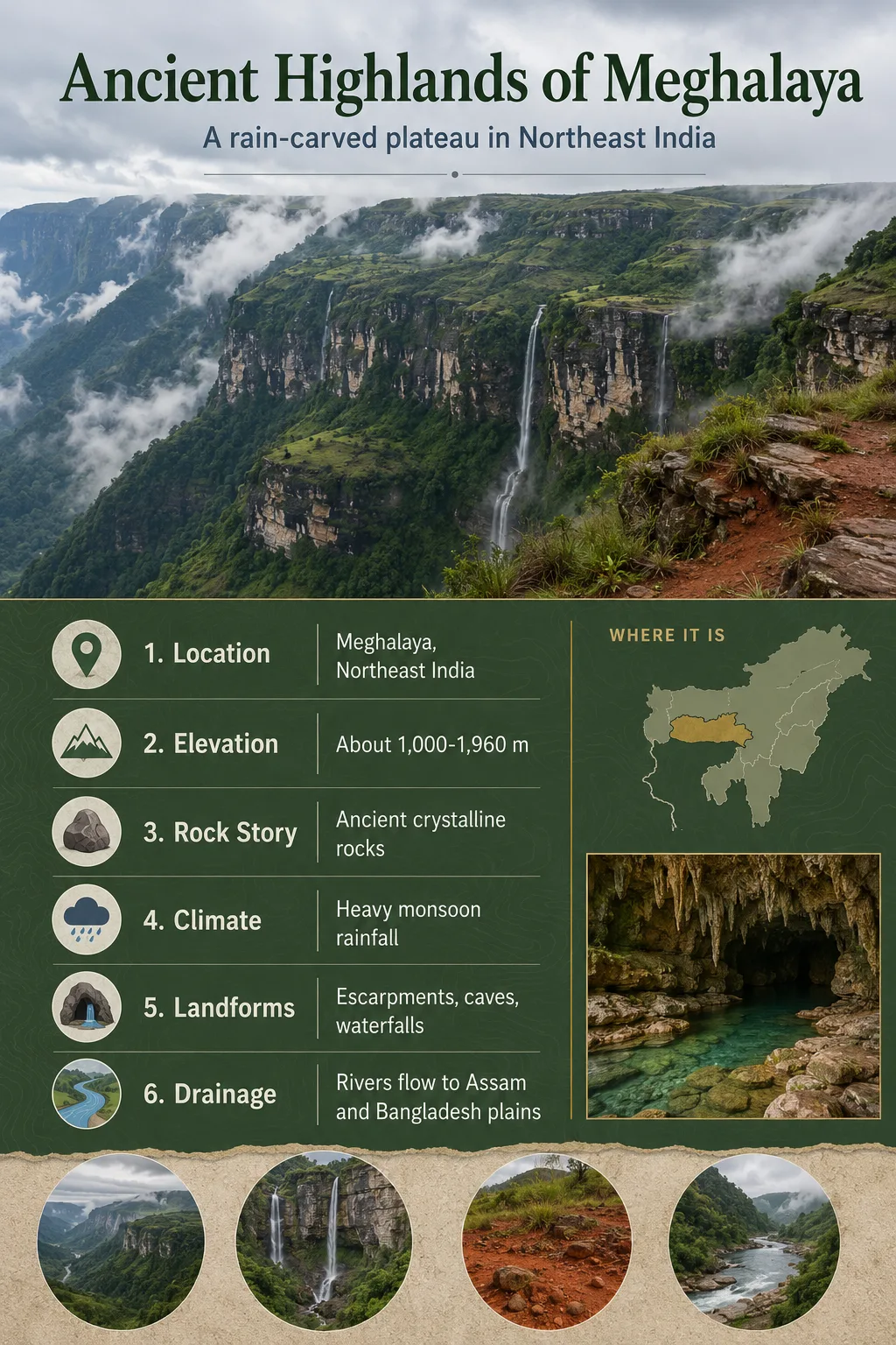
The Shillong Plateau is the raised, fault-bounded highland of Meghalaya in Northeast India. It links old Indian Shield rocks with steep monsoon slopes, high rainfall, deeply cut valleys and the Garo, Khasi and Jaintia hill country.
The Shillong Plateau is often described together with the Meghalaya Plateau, because the raised block underlies much of Meghalaya. It is not a Himalayan fold mountain range. Its core belongs to the older Indian Peninsular Shield, but its present height and sharp margins reflect later uplift along faults.
| Feature | Shillong Plateau Profile |
|---|---|
| Name Used | Shillong Plateau; often treated as part of the broader Meghalaya Plateau |
| Location | Meghalaya, Northeast India, between the Brahmaputra Valley to the north and the Bangladesh plains to the south |
| Main Hill Sectors | Garo Hills in the west, Khasi Hills in the central part, Jaintia Hills in the east |
| Typical Elevation | Central Khasi uplands commonly near 1,500 m; western Garo areas are generally lower |
| Highest Area | Shillong Peak area, usually reported near 1,965 m |
| Landform Type | Fault-bounded shield plateau, locally dissected by valleys and escarpments |
| Geological Base | Precambrian gneissic complex, Shillong Group rocks, granitic intrusions, Sylhet Trap rocks and younger sedimentary formations |
| Climate Pattern | Monsoon highland climate, with very wet southern slopes and cooler central uplands |
| Known For | Ancient shield rocks, strong monsoon rainfall, steep southern escarpments, river divides and the Shillong city highland setting |
Map Note
Google Maps gives a useful general location for the Shillong Plateau, but it should not be read as a scientific boundary map. The plateau is a broad raised region, not a single sharply pinned point.
Why the Shillong Plateau Is an Ancient Plateau
The word ancient fits the Shillong Plateau because much of its foundation is made of very old crystalline and metamorphic rocks. The basement includes Precambrian gneisses, quartz-rich rocks of the Shillong Group and granite bodies that form part of the Indian Shield.
This does not mean the surface has stayed unchanged for billions of years. The old rock base has been lifted, fractured, weathered and cut by rivers. The result is a plateau with two time scales at once: old rocks below and a younger raised landscape above.
Geography Note
The Shillong Plateau is sometimes grouped with Peninsular India because of its shield-rock base, even though it sits in Northeast India near the Himalaya, the Brahmaputra Valley and the Bangladesh plains.
Position Between the Brahmaputra Valley and Bangladesh Plains
The plateau stands as a raised block between two very different lowlands. To the north lies the Brahmaputra Valley of Assam. To the south, the land drops toward the Surma-Meghna lowlands of Bangladesh. This north-south contrast gives the plateau much of its map character.
Its southern edge is especially clear. The land falls steeply from the Khasi and Jaintia uplands toward Bangladesh, where moist monsoon air is forced upward against the plateau front. This helps explain why the southern Meghalaya slope includes some of the wettest places on Earth.
From west to east, the plateau is commonly described through three hill sectors:
- Garo Hills, the lower western part, with broad uplands and Nokrek as a high area.
- Khasi Hills, the central highland zone, including Shillong and Shillong Peak.
- Jaintia Hills, the eastern sector, with limestone, coal-bearing formations and dissected terrain.
Elevation, Relief and Escarpments
The central Khasi uplands form the highest and most recognizable part of the Shillong Plateau. Around Shillong, elevations commonly sit near 1,500 m, while Shillong Peak rises to about 1,965 m. This gives the city and nearby uplands a cooler highland setting compared with the surrounding lowlands.
The western Garo Hills are generally lower. Many areas range roughly from 450 m to 600 m, though higher points such as Nokrek rise well above the surrounding uplands. The eastern Jaintia sector varies with ridges, valleys and exposed sedimentary belts.
Elevation Note
Elevation values vary by whether a source refers to Shillong city, Shillong Peak, the central Khasi uplands or the wider Meghalaya Plateau. For the plateau as a whole, it is better to use ranges and named high areas rather than one single height.
How Faulting Helped Raise the Plateau
The Shillong Plateau is often explained as a basement uplift block. In simple terms, strong crustal rocks were pushed upward along major faults instead of being folded into long young mountain chains like the Himalaya.
Old Shield Rocks Form the Base
Precambrian gneisses, quartzites and granitic rocks make up much of the plateau’s hard foundation.
Faults Define the Raised Block
The plateau is bounded and shaped by fault systems, including the well-known Dauki Fault along the southern margin.
Uplift Creates Strong Relief
The raised block stands above the Brahmaputra and Bangladesh lowlands, giving the region steep edges and high divides.
Rain and Rivers Cut the Surface
Heavy monsoon rainfall and short, fast rivers dissect the plateau into ridges, valleys, gorges and escarpment slopes.
The Dauki Fault is especially important for understanding the southern margin. It marks a sharp structural break between the plateau and the Bengal Basin area to the south. Other fault zones and crustal movements also help explain why this old shield fragment stands high in Northeast India.
Rock Layers and Geological Variety
The plateau is not made of one rock type. Its geology includes old basement rocks, metasedimentary rocks, igneous intrusions, volcanic units and younger sedimentary formations. This mix helps explain why the landscape changes across short distances.
| Geological Unit or Material | Where It Matters in the Plateau Story |
|---|---|
| Precambrian gneissic complex | Forms part of the old crystalline basement beneath central, northern and eastern sectors |
| Shillong Group rocks | Includes quartz-rich metasedimentary rocks exposed in parts of the plateau |
| Granite plutons | Intruded older rocks and locally shape resistant uplands and weathered granite landscapes |
| Lower Gondwana rocks | Reported mainly in western Garo areas, with sandstone, pebble beds and carbonaceous shale |
| Sylhet Trap | A volcanic unit exposed in a narrow belt along the southern Khasi border area |
| Cretaceous-Tertiary sediments | Common toward the southern plateau margin, including formations linked with limestone and coal-bearing belts |
| Alluvium | Found mainly in river valleys and lower border areas where streams deposit sediment |
This geological variety is one reason the Shillong Plateau should not be treated as a simple flat tableland. It is a dissected highland block with a hard rock core, sedimentary margins and local volcanic rocks.
Monsoon Climate and the Wet Southern Face
The plateau’s climate changes with elevation and exposure. The central uplands around Shillong are cooler than the plains, while the lower western and southern margins are warmer and more humid. The wet season usually dominates from late spring into autumn, followed by a drier winter period.
The southern Khasi-Jaintia slope is famous because moist air from the Bay of Bengal rises against the plateau edge. Places such as Mawsynram and Cherrapunji sit near this rain-facing slope, where annual rainfall can reach extreme values by global standards.
Field Note
High rainfall does not mean the whole plateau is equally wet. Rainfall, temperature and vegetation change between the southern escarpment, central uplands, western Garo Hills and northern slopes.
Rivers, Water Divides and Drainage Basins
The Shillong Plateau works as a water divide. Streams on the northern side drain toward the Brahmaputra system, while many southern streams flow toward the Meghna system through Bangladesh. This divide is one of the most useful ways to understand the plateau on a map.
Because the plateau is high, wet and steep in many places, its rivers can be short, fast and deeply incised. They cut valleys into the plateau surface and carry sediment toward the surrounding lowlands. In the south, small rivers descend quickly toward Bangladesh; in the north, drainage connects with the Assam plains.
Northern Drainage
Brahmaputra Side
Streams flow down toward Assam and join the wider Brahmaputra drainage system.
Southern Drainage
Meghna Side
Many rivers descend toward Bangladesh and the Surma-Meghna lowland system.
Central Divide
Khasi Uplands
High ground near the central plateau helps separate north-flowing and south-flowing drainage.
Landscape Patterns Across Garo, Khasi and Jaintia Hills
The Garo, Khasi and Jaintia sectors share a plateau base, but they do not look the same on the ground. The Garo Hills in the west are lower on average and include rounded uplands, forested ridges and valleys. The Khasi Hills form the central highland around Shillong, with cooler elevations and strong relief near the southern edge.
The Jaintia Hills in the east show a different mix of plateau upland, limestone areas, coal-bearing formations and valleys. This eastern terrain helps connect the Shillong Plateau with the wider hill systems of Northeast India, while still keeping its shield-plateau identity.
Landform Note
The Shillong Plateau is not a plain surface. It is better described as a raised plateau region with hills, ridges, escarpments, basins and river-cut valleys.
Why It Is Not a Himalayan Plateau
The Shillong Plateau sits near the Himalayan foreland, but its origin is different from the young folded mountains to the north and east. The plateau’s old crystalline rocks link it more closely with the Indian Shield. Its raised shape comes from faulting and uplift of a hard basement block.
Shillong Plateau
- Built on old Indian Shield rocks
- Raised as a fault-bounded block
- Has plateau surfaces cut by rivers
- Includes Garo, Khasi and Jaintia hill sectors
Young Fold Mountains
- Form mainly through folding and thrusting of younger belts
- Often show long parallel ridges and valleys
- Have a different tectonic history from shield plateaus
- Are not the same landform type as the Meghalaya uplift block
Human Geography on the Plateau
Shillong, the capital of Meghalaya, sits on the central part of the plateau. Its elevation gives it a cooler climate than many surrounding lowland cities. Roads across the plateau often follow ridges, passes and valley margins because the terrain changes quickly.
Settlement, farming and forest use vary with slope, soil, rainfall and access. The plateau supports towns, villages, grasslands, forests, orchards and wet valleys. In many places, land use must work with thin soils, heavy rain and fast runoff.
The plateau is also closely tied to the cultural regions of the Khasi, Garo and Jaintia peoples. A geography article should treat those regions as living landscapes, not just as labels on a physical map.
Common Misreading of the Name
Common Mix-Up
Shillong Plateau and Meghalaya Plateau are often used close together, but they are not always used with identical boundaries. Some sources use Shillong Plateau for the uplifted block around Meghalaya, while others use Meghalaya Plateau as the broader regional term.
Another mix-up comes from the word hill. The Garo, Khasi and Jaintia Hills are not separate from the plateau idea; they are the named hill sectors that make up much of the raised plateau region. A plateau can contain hills when rivers and weathering have cut into it over time.
Related Plateau Terms
Plateau
A raised land area that stands above surrounding terrain. It may be flat, rolling or deeply dissected.
Shield Plateau
A plateau linked to old, stable continental rocks. The Shillong Plateau fits this idea because of its ancient basement.
Horst Block
A raised crustal block bounded by faults. Some geological descriptions treat the plateau as a horst-like uplift.
Escarpment
A steep slope or edge separating higher land from lower land. The southern margin toward Bangladesh is a strong example.
Drainage Divide
High ground that separates river systems. The plateau helps divide Brahmaputra-side drainage from Meghna-side drainage.