INTERACTIVE CONTEXT MAP
Where is Ladakh Plateau?
The selected plateau and nearby mapped locations are shown. Open the full world atlas to explore every region.
Trans-Himalayan High Plateau Region
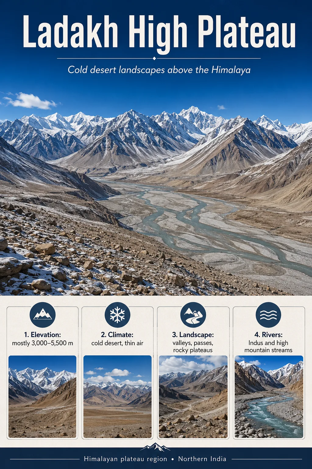
The Ladakh Plateau is not a single flat tableland. It is a very high, cold and dry Trans-Himalayan region where broad plains and closed basins alternate with mountain ranges, deeply cut river valleys and glacier-fed wetlands. Its landscape records both the India–Asia collision and the continuing work of rivers, frost, glaciers and erosion.
Cold-desert terrain
Indus–Changthang system
What the Name “Ladakh Plateau” Actually Covers
Ladakh Plateau is a useful regional geographic term, but it does not describe one perfectly bounded, uniformly flat surface. In broad physical-geography usage, it refers to the high Trans-Himalayan country associated with Ladakh between the major mountain systems of the northwestern Himalaya. Educational descriptions commonly place it between the Zanskar side of the Himalaya and the Karakoram, while more detailed regional studies divide the area into mountain ranges, river corridors, high plains and enclosed basins.
This difference in scale matters. Ladakh contains the Ladakh Range, but the range is not the same landform as the Ladakh Plateau. The Nubra and Shyok valleys are valleys within the wider highland system, not plateaus themselves. In eastern Ladakh, Changthang forms a distinct high-plateau landscape that continues the broader Tibetan Plateau system into Ladakh.
Geography Note
“Ladakh,” “Ladakh Plateau,” “Ladakh Range” and “Changthang” should not be used as interchangeable names. Ladakh is the wider region; the Ladakh Range is a mountain chain; Changthang is a high plateau and basin landscape in the east; and “Ladakh Plateau” is used at different map scales for the larger elevated Trans-Himalayan setting.
A simplified north-to-south view helps show why the region cannot be understood as a single slab of elevated land.
Very high mountain terrain and major glacier systems north of Ladakh’s interior valleys.
Broad river valleys and sediment-filled corridors between high mountain blocks.
A major Trans-Himalayan mountain belt separating the Shyok–Nubra system from the Indus corridor.
The main longitudinal river valley through central Ladakh, with terraces, fans and many settlements.
High relief south of the Indus, leading toward the Greater Himalayan system.
This sequence is schematic and is intended to show regional relationships rather than exact widths or boundaries.
A Plateau Made of Plains, Valleys and Mountain Blocks
The Ladakh Plateau looks unusually rugged because regional elevation and local relief are different things. The whole landscape stands at great altitude, yet the surface has been split by mountain building, faulting, river incision and glacial processes. A broad high region can therefore contain steep ridges and deep valleys without losing its plateau-scale identity.
Eastern Ladakh shows the plateau character most clearly. Changthang contains rolling high ground, open plains, salt basins, wetlands and broad depressions separated by ranges that rise well above them. Elsewhere, the Indus, Shyok and their tributaries have cut or occupied long valleys between mountain belts.
| Landscape Unit | Surface Character | Geographic Role |
|---|---|---|
| Indus Valley | River corridor, terraces and alluvial surfaces between high ranges | Forms Ladakh’s principal central drainage and settlement axis |
| Shyok–Nubra System | Broad mountain valleys with braided channels, sediment deposits and locally sandy surfaces | Creates a lower corridor through the high terrain north of the Ladakh Range |
| Changthang | High plains, rolling uplands, closed basins, lakes and steppe | Represents Ladakh’s strongest physical connection with the Tibetan Plateau |
| Depsang Plains | Very high, relatively open terrain compared with surrounding mountains | Shows that broad low-relief surfaces occur within an otherwise rugged region |
| More Plains | Elevated open plain along the southern approach to central Ladakh | Another example of locally broad plateau-like terrain among mountain systems |
| Ladakh and Zanskar Ranges | High ridges, steep slopes and deeply weathered mountain terrain | Break the plateau region into separate valleys, basins and high surfaces |
The result is better described as a plateau-and-mountain complex than as an uninterrupted high plain. The plateau identity appears at regional scale; the mountains, valleys and basins dominate the landscape at local scale.
Why One Average Elevation Is Misleading
Published descriptions give noticeably different elevations for the Ladakh Plateau because they are often measuring different things. Some refer to eastern high plains, others to the wider Ladakh region, and others mix plateau surfaces with surrounding mountains. A single number therefore creates more precision than the geography supports.
Leh, in the Indus corridor, lies at about 3,500 metres above sea level. Much of Changthang is substantially higher, with its plains commonly around 4,500–5,000 metres. Mountain ridges and summits rise far above both. Other valleys descend below the elevation of the eastern plateau surfaces.
Elevation Is Scale-Dependent
A valley-floor elevation, a plateau-surface elevation and a mountain-summit elevation describe three different parts of the landscape. Statements that assign one exact “average elevation” to all of Ladakh should therefore be treated cautiously unless the mapped boundary and measurement method are defined.
This vertical range also explains why two places within Ladakh can have very different landforms and environmental conditions even though both belong to the same high-altitude region. A relatively sheltered river terrace near the Indus does not function like a wind-exposed Changthang basin more than a kilometre higher.
The Collision Zone Beneath the Landscape
Ladakh occupies one of the clearest surface expressions of the tectonic history that joined the Indian and Eurasian continental systems. Before continental collision, the Neo-Tethys Ocean separated India from Asia. Oceanic lithosphere was progressively consumed beneath the Asian margin, producing volcanic and intrusive magmatism before the two continental masses met.
The most important geological line through Ladakh is the Indus Suture Zone. It marks the broad tectonic boundary associated with the closure of the Neo-Tethys and the collision of India with Asia. The zone contains a complicated mixture of sedimentary, volcanic and oceanic-affinity rocks rather than a simple fault line.
Oceanic crust once separated the Indian continental margin from Asia.
Oceanic lithosphere descended beneath the Asian margin and fed a long-lived magmatic arc.
India reached the Asian margin as the intervening ocean closed, producing intense shortening and deformation.
Continued convergence raised the wider Himalaya–Tibet region while rivers, glaciers and weathering cut into the elevated terrain.
The Ladakh Batholith Records an Older Magmatic Arc
Much of the Ladakh Range is associated with the Ladakh batholith, a large body dominated by granitic to granodioritic intrusive rocks. These rocks formed from magma connected with subduction along the southern Asian margin before and around the transition to continental collision.
This distinction is important. The present highland was not created by one simple event in which two plates collided and instantly produced a plateau. Ladakh preserves an older subduction-related magmatic history followed by continental collision, crustal shortening, uplift, faulting, erosion and sedimentation.
Collision Timing Is Not a Single Settled Date
Geologists agree on the broad sequence of Neo-Tethys closure and India–Asia collision, but the exact timing assigned to the first continental contact depends on which geological evidence is used. Recent work on the Indus Suture Zone continues to refine the ages and origins of sediments used to reconstruct that transition. For a landform description, the important point is that Ladakh sits directly across the geological zone where two major continental systems became joined.
The Indus Is the Main Corridor Through the High Country
The Indus River does more than drain Ladakh. It organizes much of the region’s physical geography. Its valley forms a long corridor between major mountain belts, receives tributaries from surrounding high terrain and provides broad sedimentary surfaces that contrast sharply with the rocky slopes above.
Where streams emerge from steep side valleys, they lose energy and spread gravel, sand and finer sediment across the main valley floor. Repeated deposition builds alluvial fans, fan-shaped surfaces that are among the most useful pieces of terrain in an otherwise steep and dry region.
The Shyok and Nubra system shows another form of mountain drainage. Wide valley floors can carry multiple shifting channels across loose sediment, producing braided river patterns. Such valleys may look broad and relatively level from above, but they are erosional and depositional corridors cut between mountain blocks rather than surviving pieces of a uniform plateau top.
Groundwater Collects in the Valley Fill
Ladakh appears almost waterless across many slopes, but part of its water system is stored below the surface. Moraines, alluvial sediments and fluvio-glacial deposits in some valleys are porous enough to hold groundwater. Snowmelt, glacier melt, stream seepage and limited precipitation can recharge these deposits.
This creates a strong contrast between bedrock slopes and sediment-filled valleys. The steep slopes shed water rapidly, while coarse valley deposits can transmit and store some of it underground. Groundwater is therefore part of the same mountain-to-valley system as glaciers, streams and irrigation channels rather than an isolated resource.
Why Ladakh Is a Cold Desert
Ladakh is extremely high and cold, yet much of it is also a desert. The main reason is the rain-shadow effect of the Himalayan mountain system. Moist air associated with the South Asian monsoon loses much of its moisture before it can penetrate deeply into the Trans-Himalayan interior.
Parts of eastern Ladakh receive only around 100 millimetres of precipitation in a year. Low humidity, strong solar radiation, long cold winters and large day-to-night temperature changes add to the aridity. Vegetation remains sparse across exposed slopes and plains because low precipitation combines with cold temperatures, thin soils and a short growing season.
The Cold-Desert Paradox
A desert is defined by lack of precipitation, not by absence of ice. Ladakh can contain glaciers, seasonal snow, frozen ground, streams and wetlands while remaining one of South Asia’s driest high-altitude landscapes.
Most slopes therefore show extensive bare rock, scree and thin sandy or loamy soils. Physical weathering is strong. Repeated freezing and thawing breaks rock along fractures, while gravity moves loose material downslope. Sparse vegetation leaves much of this material exposed to wind and sudden runoff.
Closed Basins Explain Ladakh’s High-Altitude Lakes
Eastern Ladakh differs from the strongly integrated Indus drainage because parts of Changthang contain endorheic basins. Water entering these depressions does not necessarily reach the sea through an external river system. Instead, snowmelt and glacier-fed streams collect in lakes and wetlands where water is lost mainly through evaporation.
This weak external drainage is one reason salts can accumulate. Dissolved minerals enter with inflowing water; evaporation removes water but leaves many dissolved substances behind. Over time, lake chemistry can become brackish or strongly saline.
| Lake or Wetland | Approximate Elevation | Hydrologic Character | What It Shows About the Plateau |
|---|---|---|---|
| Pangong Tso | About 4,350 m | High-altitude saline lake in an internally drained basin system | Demonstrates how large lakes can persist within an extremely dry mountain plateau environment |
| Tso Moriri | About 4,520 m | Brackish endorheic lake fed largely by snow- and glacier-related runoff | Shows the close connection between high mountains, meltwater and a closed plateau basin |
| Tso Kar Wetland Complex | Above 4,500 m | Includes freshwater Startsapuk Tso and hypersaline Tso Kar | Shows how freshwater and salt-rich environments can develop close together under the same cold-arid climate |
Tso Kar is particularly useful for understanding the process. Evaporation concentrates salts in the larger saline lake and produces characteristic pale salt deposits around its margins, while nearby freshwater habitat persists where the local water balance differs.
Wetlands Form Productive Patches Inside the Desert
Water changes the ecological character of Changthang over very short distances. Dry steppe and sparsely vegetated ground can give way to sedge meadows, marshes and shallow-water habitat around streams and lake margins. These wet areas support a much greater concentration of biological activity than surrounding barren surfaces.
High-altitude wetlands are used by birds including the black-necked crane and bar-headed goose, while the wider plateau-steppe environment supports mammals adapted to cold, open terrain. Their distribution is closely tied to water, grazing habitat and relief rather than being uniform across the plateau.
Frozen Ground Extends Beyond the Glaciers
Ladakh’s cryosphere is often discussed only in terms of glaciers, but parts of Changthang also contain permafrost-affected ground. Permafrost is ground that remains at or below freezing for at least two consecutive years, even when the surface layer thaws seasonally.
Research published in 2025 documented permafrost-affected soils around Jukti and Tso Kar in Changthang at roughly 4,535 metres elevation. Earlier subsurface observations in the wider area had also identified discontinuous high-altitude permafrost. This confirms that frozen-ground processes are part of the plateau environment rather than being restricted to visible glacier ice.
Seasonal thaw can temporarily wet the active surface layer above frozen material. That helps explain why moist grass and sedge communities can occur in very dry high-altitude terrain where annual precipitation alone would suggest little available water.
Glacier Change Is Uneven Across Ladakh
Glaciers in the mountains around the plateau act as frozen water stores and contribute meltwater to rivers, streams and closed basins. They are changing as the regional climate warms, but there is no scientifically useful single shrinkage rate for every glacier in Ladakh.
Glacier response varies with elevation, size, slope, aspect, debris cover and local climatic conditions. A small glacier confined to a narrow elevation band may react differently from a larger glacier whose upper accumulation area reaches much higher terrain.
Karzok Range Case Study
A glacier inventory published in 2026 examined 276 glaciers across five massifs of the Karzok Range in eastern Ladakh. The combined mapped glacier area declined by 25.6% between 1980 and 2023, from about 169.4 km² to 125.4 km². Loss varied markedly between the individual massifs, so the figure describes the Karzok study area rather than all glaciers in Ladakh.
The same research found that smaller, lower and more altitudinally restricted glaciers tended to be more sensitive to area loss. This local variability is why regional glacier measurements should be attached to their study basin or mountain range instead of being presented as a universal Ladakh value.
Changes in glacier and seasonal-snow storage matter far beyond the ice itself. They alter the timing and amount of meltwater entering streams, groundwater recharge zones, wetlands and irrigated valley floors.
Water Determines Where Settlement Is Possible
The pattern of settlement in Ladakh closely follows physical geography. Large areas of plateau and mountain slope remain sparsely inhabited, while villages and cultivated land cluster around river terraces, alluvial fans, springs and dependable meltwater streams.
Alluvial fans are especially useful because they can provide relatively stable, gently sloping surfaces beside a main valley while small side streams supply water from higher ground. Along parts of the Indus corridor, these fans and terraces create pockets where irrigation can turn otherwise dry sediment into cultivated land.
High mountains accumulate part of their water as seasonal snow and glacier ice.
Meltwater descends through tributary valleys, springs and mountain streams.
Water reaches gentler sedimentary surfaces where channels and irrigation can spread it.
Reliable water produces narrow green settlement zones within an otherwise cold-arid landscape.
Eastern Changthang supports a different relationship with the land. Its broad high-altitude steppe and seasonal pastures have long supported Changpa pastoralism, in which livestock movement is adapted to grazing availability, water and severe seasonal conditions. The open plateau surface is therefore used differently from the more intensively settled and irrigated Indus corridor.
Why a Desert Plateau Can Produce Flash Floods
Very low annual precipitation does not prevent destructive flooding. In fact, several characteristics of Ladakh can make short, intense rainfall especially effective at moving water and sediment.
Steep mountain catchments deliver runoff rapidly. Sparse vegetation offers limited resistance. Loose scree, sand, gravel and weathered rock provide abundant sediment. When intense rainfall occurs over one of these catchments, water can concentrate quickly in narrow channels and emerge onto a valley floor as a sediment-rich flash flood or debris flow.
This process is different from the long-duration flooding of a humid lowland river. A catchment that remains dry for much of the year can still respond violently to a brief local storm.
Earthquake Risk Comes From the Same Tectonic Setting
Ladakh also remains within an active mountain belt created by continental convergence. Official hazard classification places the region in India’s Seismic Zone IV, a high-damage-risk category. Earthquakes can directly affect settlements and infrastructure and can also destabilize steep slopes already weakened by fractures, weathering and loose sediment.
Avalanches, landslides, rockfall and flash floods therefore should not be treated as unrelated hazards. They reflect the combination of extreme relief, active tectonics, cold-climate weathering, sparse vegetation and strongly seasonal water movement across the high terrain.
Why Ladakh Still Fits the Plateau Category
The rugged appearance of Ladakh can make the word plateau seem contradictory. That apparent contradiction disappears when the landscape is viewed at the correct scale. A plateau does not need to be perfectly level, and mountains can rise from a much larger elevated regional surface.
Ladakh occupies an exceptionally high Trans-Himalayan setting with extensive uplands, plains and enclosed basins between major mountain systems. It has also been strongly dissected and deformed. Rivers have cut long valleys through it, mountain ranges divide it into separate terrain units, and glaciers and frost continue to reshape its highest parts.
Its most plateau-like expression appears in the broad eastern highlands of Changthang and in named open plains such as Depsang and More Plains. Its most dissected expression appears along the Indus, Shyok, Nubra and other river corridors. Taken together, these landforms make Ladakh best understood as a tectonically elevated, intermontane high-plateau region whose original regional height is expressed through a mosaic of plains, basins, valleys and mountain blocks.