INTERACTIVE CONTEXT MAP
Where is Chota Nagpur Plateau?
The selected plateau and nearby mapped locations are shown. Open the full world atlas to explore every region.
Eastern India • Dissected Plateau • Mineral Belt
The Chota Nagpur Plateau is a stepped highland centred on Jharkhand, where ancient crystalline rocks, coal-bearing rift basins, laterite-capped uplands and deeply cut river valleys meet within one broad landform region.
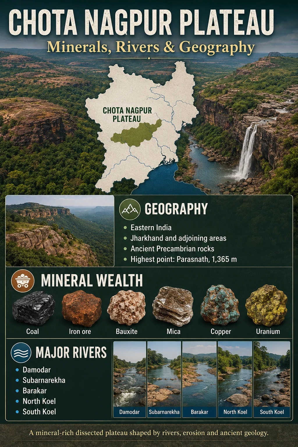
The Chota Nagpur Plateau is the northeastern part of India’s Peninsular Plateau. Much of it lies in Jharkhand, with adjoining terrain in northern Odisha, western West Bengal, northern Chhattisgarh and southern Bihar. Its surface is not one level tableland. It is a group of upland surfaces, faulted valleys, scarps, residual hills and lower plateaus shaped from several rock belts.
The region is known for coal, iron ore, bauxite, copper and mica, but the deposits do not occur as one uniform mineral layer. Each belongs to a particular geological setting: coal to Gondwana sedimentary basins, iron ore to the Singhbhum iron formations, copper to the Singhbhum shear zone, bauxite to deeply weathered plateau caps, and mica to pegmatite belts around Koderma and Giridih.
| Profile Measure | Chota Nagpur Plateau |
|---|---|
| Location | Eastern India, centred on Jharkhand |
| Approximate area | About 65,509 km² under the classical Ranchi-Hazaribagh-Koderma definition; wider mapped regions may be much larger |
| Typical elevation | Roughly 300–1,100 m across the main surfaces; local summits rise higher |
| Highest point | Parasnath Hill (Shikharji), about 1,365 m |
| Landform character | Dissected and stepped plateau with pats, scarps, troughs, residual hills and river-cut valleys |
| Main drainage directions | North toward the Son-Ganga system; east toward the Hooghly; south and southeast toward the Bay of Bengal |
| Major mineral settings | Damodar Gondwana basins, Singhbhum Craton and shear zone, Koderma-Giridih pegmatite belt, western lateritic pats |
Where the Plateau Sits in Eastern India
The Indo-Gangetic Plain lies along the north and northeast. The Mahanadi basin and the Odisha highlands lie to the south, while the lower Bengal plains open to the east. On the west, the uplands merge gradually with Surguja and other central Indian highlands. These are physiographic transitions rather than surveyed administrative borders.
Map Note
The map is useful for regional orientation, but its place label does not trace a scientific plateau boundary. Geological, ecological and classical physiographic studies use different outer limits.
A Plateau Built from Several Levels
The clearest way to understand the relief is to treat it as a set of erosional surfaces at different heights. Broad uplands stand above fault-guided valleys, and resistant hills rise above surfaces worn down over long periods. The main divisions are related, but each has a different elevation pattern and landscape.
| Physiographic Unit | Approximate Elevation | Position and Character | Geographic Markers |
|---|---|---|---|
| Western Pat region | Mostly about 900–1,100 m | Highest broad plateau surfaces in the west; flat or gently rolling summits with lateritic caps | Netarhat, Pakripat and smaller pats; merges toward Surguja |
| Ranchi Plateau | Average about 700 m | Largest central surface, gently tilted and strongly cut along its margins | Ranchi, Subarnarekha headwaters, South Koel headwaters and several scarp waterfalls |
| Hazaribagh Plateau | Average about 610 m | Higher northern block separated from Ranchi by the Damodar trough | About 64 km east-west and 24 km north-south in the often-cited core area |
| Koderma Plateau | Commonly about 300–450 m; local ridges reach higher | Lower northern surface, often treated as the lower Hazaribagh Plateau | Pegmatite and mica belt; Koderma district averages about 397 m |
| Damodar trough | Lower than the adjoining Ranchi and Hazaribagh surfaces | Fault-controlled east-west basin filled with Gondwana sedimentary rocks | Jharia, Bokaro, Ramgarh and Karanpura coal-bearing areas |
| Palamu Plateau and valleys | Highly varied; broad inner tracts are lower than the western pats | Parallel hill ranges, basins and valleys drained mainly by the North Koel system | North Koel, Auranga, Amanat and the Netarhat escarpment to the south |
| Manbhum-Singhbhum uplands | Many lower surfaces near 300 m, with hills above 1,000 m | Rugged southeastern plateau and hill country over mixed ancient rock belts | Dalma Hills, Singhbhum mineral belt, Subarnarekha and South Koel drainage |
Measurement Note
The often-repeated area of about 65,509 km² follows a narrower classical definition centred on the Ranchi, Hazaribagh and Koderma plateaus. A modern terrain-mapping study used a study area of about 130,000 km² by including a wider Chota Nagpur Plateau region. The difference comes mainly from boundary choice, not from a change in the landform.
Parasnath Is a Summit, Not the Average Surface
Parasnath Hill, also known as Shikharji, rises to roughly 1,365 m in the eastern part of the plateau region. It is the highest point, but it should not be used as the plateau’s general elevation. The main Ranchi and Hazaribagh surfaces are several hundred metres lower, while the western pats form the highest broad tablelands.
Why Different Rocks Hold Different Minerals
The plateau crosses more than one geological province. The Chhotanagpur Granite Gneiss Complex dominates much of the north and centre. The North Singhbhum Fold Belt forms a deformed zone farther south, and the older Singhbhum Craton underlies much of the southern mineral country. Younger Gondwana sediments fill faulted troughs such as the Damodar basin.
Ancient Crystalline Basement
Granites, gneisses, schists, quartzites and related metamorphic rocks formed the hard foundation. Repeated deformation, heating and intrusion created several ore-bearing zones.
Faulted Basins Collected Sediment
Down-faulted troughs received river, lake and swamp deposits during Gondwana time. Buried plant matter became coal seams within sandstone and shale sequences.
Uplift and Long Erosion Made Steps
Broad regional uplift and prolonged denudation left several plateau levels. Rivers then cut into their edges and exposed older rock belts.
Tropical Weathering Made Residual Ores
Deep chemical weathering removed mobile elements from stable upland surfaces. Aluminium- and iron-rich material remained, forming laterite and bauxite on some western pats.
This sequence is a simplified landscape history, not a single four-stage event. The basement rocks have separate and very old histories, the Gondwana basins formed later, and the present relief reflects more than one phase of uplift, weathering and river incision.
Mineral Belts and Their Geological Setting
The useful geographic question is not simply which minerals occur, but why each one is concentrated where it is. The table separates major deposits by rock setting and subregion.
| Mineral or Resource | Main Plateau Belt | Geological Setting | Representative Areas | Main Use |
|---|---|---|---|---|
| Coal | Damodar and adjoining Gondwana basins | Coal seams in Gondwana sandstones and shales deposited in faulted basins | Jharia, East and West Bokaro, Ramgarh, North and South Karanpura, Giridih; Raniganj on the eastern continuation | Electricity, coke and steelmaking |
| Iron ore | Southern Singhbhum belt | Haematite-rich banded iron formations and associated ancient supracrustal rocks | Noamundi, Gua, Kiriburu, Meghahatuburu and nearby West Singhbhum deposits | Iron and steel |
| Copper | Singhbhum shear zone | Sulphide mineralisation along a long deformed and sheared rock belt | Mosabani, Surda, Rakha, Kendadih and Ghatsila belt | Electrical, alloy and engineering uses |
| Bauxite | Western high pats | Residual concentration produced by intense lateritic weathering on stable upland caps | Lohardaga, Gumla and Latehar districts; Pakhar and adjoining plateaus | Alumina and aluminium |
| Mica | Northern pegmatite belt | Mica-bearing pegmatite veins intruded into crystalline rocks | Koderma, Giridih and the northern Hazaribagh region | Electrical insulation, fillers and specialist industrial products |
| Uranium | East Singhbhum mineral belt | Mineralised zones associated with deformed rocks near the Singhbhum shear system | Jaduguda and adjoining East Singhbhum deposits | Nuclear fuel after controlled processing |
| Manganese and kyanite | Singhbhum and Saraikela-Kharsawan belts | Ancient metamorphic and iron-ore-series rocks | Parts of East and West Singhbhum; kyanite also in Saraikela-Kharsawan | Alloys and refractory materials |
| Limestone and dolomite | Scattered sedimentary and metamorphic belts | Carbonate rock units rather than one continuous plateau-wide layer | Parts of Palamu, Garhwa, Ranchi, Hazaribagh, Bokaro and Singhbhum | Cement, flux and construction materials |
| Graphite, apatite and related minerals | Local metamorphic belts | Concentrations within selected metamorphic and intrusive rock zones | Graphite in Palamu; apatite and associated minerals in parts of the Singhbhum belt | Refractories, batteries, pencils, phosphorus products and industrial uses |
Data Note
Jharkhand mineral totals are often presented as if they describe the whole Chota Nagpur Plateau. They do not. The plateau crosses state boundaries, while Jharkhand also contains terrain whose inclusion varies by physiographic definition. “Resource,” “reserve,” “production” and “ore mined” are also different measures.
Dated Mineral Resource Snapshot for Jharkhand
The figures below give scale to the mineral belts, but they are state inventory totals, not calculated totals for the plateau. “Total resources” combines reported reserves with remaining resources and does not mean that the entire quantity is ready for extraction.
| Commodity | Reported Total Resources | Inventory Date | Boundary Caution |
|---|---|---|---|
| Coal | 91,811.57 million tonnes | 1 April 2024 | Jharkhand total includes Rajmahal and other coalfields beyond the narrow classical plateau definition |
| Haematite iron ore | 4,710.146 million tonnes | 1 April 2020 | Jharkhand total; concentrated mainly in West Singhbhum |
| Limestone | 620.765 million tonnes | 1 April 2020 | Jharkhand total across several districts and rock belts |
| Bauxite | 289.244 million tonnes | 1 April 2020 | Jharkhand total; much is associated with western lateritic uplands |
| Copper ore | 251.463 million tonnes | 1 April 2020 | Ore tonnage, not contained copper metal |
| Graphite | 20.006 million tonnes | 1 April 2020 | Jharkhand total; occurrence is concentrated mainly in the Palamu area |
| Manganese ore | 14.749 million tonnes | 1 April 2020 | Jharkhand total; reported mainly in East and West Singhbhum |
| Kyanite | 8.275 million tonnes | 1 April 2020 | Jharkhand total; mainly in Saraikela-Kharsawan and West Singhbhum |
For a production comparison, Jharkhand reported about 22.9 million tonnes of iron ore and 2.04 million tonnes of bauxite in 2023–24. Those annual outputs are much smaller than inventory totals because resource estimates and yearly mine production answer different questions.
Coal Follows the Troughs
The Damodar valley is an east-west structural trough between the Ranchi and Hazaribagh plateau blocks. Its coal occurs in separate Gondwana coalfields, not beneath every part of the plateau. The Barakar Formation contains many of the workable seams. Jharia is especially associated with coking coal, while Bokaro, Karanpura, Ramgarh and other fields contain varying coal grades.
Metal Ores Follow the Southern Rock Belts
The iron and copper districts lie mainly south of the Damodar coal country. West Singhbhum’s iron ores belong to very old iron-bearing rock sequences around the Singhbhum Craton. The copper belt runs along a deformed zone through East Singhbhum. This spatial separation explains why “mineral-rich plateau” is useful as a regional description but too broad as a geological explanation.
Bauxite Records an Old Weathered Surface
Bauxite on the western pats is a residual weathering product. It formed where long exposure, warm wet-season weather and good drainage removed silica and other soluble material while aluminium-rich residue accumulated. Its position on high, relatively level remnants also helps geographers reconstruct former erosion surfaces.
Rivers Radiate into Several Major Basins
The Chota Nagpur uplands form a broad watershed between the Ganga system to the north, the Hooghly system to the east, and rivers flowing to the Bay of Bengal through Odisha. Because the plateau is domed, stepped and broken by troughs, drainage does not run in one direction.
| River System | Plateau Relationship | Main Tributaries or Partners | Downstream Destination |
|---|---|---|---|
| Damodar | Rises in the western plateau and follows the faulted Damodar trough eastward | Barakar, Konar and Bokaro; Bhera joins at Rajrappa | Hooghly river system |
| Subarnarekha | Rises near Nagri on the Ranchi Plateau and cuts across the southeastern uplands | Kanchi and Kharkai among its main tributaries | Bay of Bengal after flowing through Jharkhand, West Bengal and Odisha |
| North Koel | Drains the western and northwestern plateau through Palamu | Auranga and Amanat | Son River, then the Ganga system |
| South Koel-Brahmani | South Koel rises on the Ranchi Plateau and drains south and southwest | South Karo; joins the Sankh near Rourkela to form the Brahmani | Bay of Bengal through Odisha |
| Sankh | Rises in the western Chota Nagpur highlands and flows through Jharkhand, Chhattisgarh and Odisha | Joins the South Koel at Vedavyas near Rourkela | Brahmani, then the Bay of Bengal |
| Eastern plateau rivers | Drain lower uplands and plateau fringes toward West Bengal | Ajay, Mayurakshi, Kangsabati-Kasai and Dwarakeswar systems | Bhagirathi-Hooghly or coastal Bengal river systems |
| Baitarani | Rises in the Gonasika hills of the adjoining Keonjhar highlands at the southeastern side of the wider plateau region | Receives short hill streams from the Odisha uplands | Bay of Bengal through the Brahmani-Baitarani delta area |
The Damodar Valley Is Both a River Corridor and a Rock Basin
“Damodar Valley” can mean the river’s drainage corridor, while “Damodar basin” in geology often refers to the faulted Gondwana sedimentary troughs that contain coal. The two overlap closely, but they are not identical ideas. The river took advantage of a structural low between higher plateau blocks.
Waterfalls Mark Breaks in the Plateau Surface
Rivers leaving the Ranchi surface cross resistant rock ledges and steep margins. Hundru Falls on the Subarnarekha, Dassam Falls on the Kanchi and Jonha Falls in the Raru drainage show how stream incision meets an escarpment or a hanging tributary valley. Farther west, Lodh Falls descends from the highland edge in the Burha River system.
The waterfalls are therefore more than isolated scenic sites. Their positions reveal abrupt changes between plateau levels, uneven river erosion and resistant bedrock.
Climate, Soils and Forest Pattern
The plateau has a tropical monsoon climate modified by elevation. Most rain falls from June to September. Annual totals vary across the region, but many central districts receive roughly 1,200–1,400 mm. Higher and more exposed tracts can be cooler and wetter than the lower valleys, while late spring is commonly hot and dry.
Weathering of granite, gneiss and related rocks has produced broad areas of red and yellow soil. Lateritic soils occur on older uplands, and micaceous soils are associated with the Koderma-Hazaribagh belt. Valley bottoms collect finer material and hold water more effectively than the gravelly or leached upper slopes.
Sal-dominated tropical deciduous forest is characteristic of much of the plateau. Moist deciduous patches occur in wetter tracts, while drier forests and open woodland occupy rain-shadowed or heavily used areas. Forest cover is uneven, with larger blocks remaining around Saranda, Palamu, Netarhat and other rugged uplands.
Field Note
A typical local slope sequence runs from a dry, leached upper surface to a cultivated middle slope and a wetter paddy-growing hollow. This small-scale relief, often called a toposequence, matters as much to farming as the plateau’s average elevation.
How Relief and Minerals Shape Settlement
Large urban and industrial centres developed where ore belts, coalfields, water and transport corridors could be linked. Dhanbad grew within the Jharia coal region. Bokaro stands near coal, rail and water infrastructure in the Damodar valley. Jamshedpur lies near the meeting of the Subarnarekha and Kharkai and within reach of Singhbhum iron ore and coal from farther north. Rourkela occupies the southern gateway where the Sankh and South Koel form the Brahmani.
Ranchi has a different setting. It sits on the broad central plateau rather than inside a major coalfield. Its relatively level upland surface supports a large city, while steep drainage breaks and waterfalls occur beyond parts of the urban plateau.
Rural land use follows the relief. Rice is concentrated in lower fields that retain monsoon water. Millets, pulses, oilseeds, maize and mixed cropping are better suited to some upland soils. Tanks, small reservoirs and seasonal stream storage are important because hard crystalline rocks usually store groundwater in weathered layers, fractures and joints rather than in thick, continuous aquifers.
2026 Hydrogeology Update
A May 2026 study of the Eastern India Plateau region mapped groundwater recharge potential under prolonged dry conditions and found that seasonal groundwater-level fluctuation was closely related to summer depletion. The results reinforce the importance of local lithology, terrain and recharge conditions rather than treating groundwater availability as uniform across plateau landscapes.
A separate June 2026 study in Gharbar gram panchayat, Baliapur block, Dhanbad district found that 36% of 315 sampled groundwater sources exceeded 1.5 mg/L fluoride. This is a local hydrogeological case study within the Jharkhand part of the Chota Nagpur Plateau and should not be treated as a plateau-wide fluoride rate.