INTERACTIVE CONTEXT MAP
Where is Bundelkhand Plateau?
The selected plateau and nearby mapped locations are shown. Open the full world atlas to explore every region.
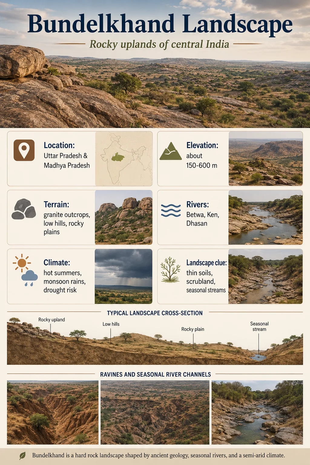
The Bundelkhand Plateau is a broad upland of north-central India shaped less like a flat table and more like an old, worn rock surface. Much of its landscape consists of rolling granitic terrain, shallow pediplains, isolated rocky hills and long quartz ridges, while major rivers cut generally northward toward the Yamuna. Toward the Panna and Vindhyan margins, the surface becomes more stepped and dissected, with tablelands, escarpments and deeply incised valleys adding a different character to the plateau.
Where the Bundelkhand Plateau Sits
The Bundelkhand Plateau forms part of the Central Highlands of India, north of the Narmada–Son system and south of the great alluvial plains associated with the Ganga and Yamuna. Its physiographic core extends across adjoining parts of northern Madhya Pradesh and southern Uttar Pradesh. In Madhya Pradesh classifications, it lies east of the Central India Plateau and northwest of the Rewa–Panna Plateau.
This position places Bundelkhand near an important landscape transition. The crystalline upland gradually gives way northward to lower terrain and the alluvial plains of the Yamuna system, while its eastern and southern margins meet more strongly expressed Vindhyan relief.
Geographic Distinction
Bundelkhand Plateau and Bundelkhand Region are not exact synonyms. Bundelkhand is also a historical, cultural and broader geographic region whose boundaries vary by definition. The physiographic plateau is a landform unit within that wider setting, so district lists or area figures for the Bundelkhand Region should not automatically be treated as measurements of the plateau itself.
A Rolling Granitic Upland, Not a Flat Tableland
The most useful way to picture the Bundelkhand Plateau is as an undulating erosional surface. Long stretches are gently rolling, but the surface is interrupted by abrupt rock hills, narrow ridges, shallow valleys and locally steeper scarps. Government physiographic descriptions for the Madhya Pradesh part commonly place much of the plateau around 350–450 m above mean sea level and describe its general slope as northward. That range is a regional average rather than a fixed elevation for every part of the wider Bundelkhand landscape.
Large areas are described as pediplains: broad surfaces produced by prolonged weathering, erosion and retreat of rocky slopes. They are not perfectly level. Cultivated ground, shallow depressions and weathered surfaces alternate with bare or thinly covered rock, while harder remnants rise above the surrounding terrain. Geological field reports from the Jhansi sector describe pediplain surfaces together with denudational hills, inselbergs and long serrated quartz ridges.
This combination explains why the plateau can look relatively open from a regional map while appearing distinctly rocky and uneven on the ground. Its plateau identity comes from the broader elevated surface, not from an uninterrupted flat top.
Ancient Crust Lies Beneath a Much Younger Landscape
The physical character of Bundelkhand is strongly tied to the Bundelkhand Craton, an old block of continental crust in the northern Indian shield. Much of the exposed basement consists of the Bundelkhand Gneissic and Granitoid complexes, together with older metamorphic rocks and younger intrusive features. Granitoids dominate much of the exposed craton, and geochronological work places major phases of Bundelkhand granitoid emplacement at roughly 2.5 billion years ago.
The granite and gneiss matter because they influence how the surface breaks down. Resistant bedrock may remain exposed as bouldery ground and low rocky hills, while more deeply weathered or fractured zones develop into gentler surfaces and valleys. Over long periods, differential weathering leaves a patchwork of broad low-relief ground and harder residual features.
Rock Age Is Not Plateau-Surface Age
The billion-year ages reported for Bundelkhand granite describe the formation of the bedrock. They do not mean that the hills, valleys, pediplains or present plateau surface have remained unchanged for billions of years. Today’s relief is the result of much later weathering, erosion, drainage development and repeated landscape modification acting on that ancient foundation.
Quartz Reefs Give the Plateau a Linear Grain
One of Bundelkhand’s most recognizable geological features is its system of large quartz reefs. Many trend northeast–southwest and form narrow, elongated ridges that stand above the surrounding granitoid terrain. Government exploration reports describe them as prominent linear hills or ridges and identify them as one of the outstanding physiographic expressions of the Bundelkhand Craton.
These reefs are ancient quartz-rich bodies emplaced along fractures and shear zones. Major reef-forming activity has been associated with tectonically controlled hydrothermal processes around 2.1–2.0 billion years ago. Once exposed at the surface, resistant quartz can survive erosion more effectively than some of the surrounding weathered rock, leaving the reef expressed as a ridge.
Structural breaks develop in the ancient crystalline crust.
Hydrothermal fluids deposit large bodies of quartz within the structural zones.
Surrounding rock is weathered and lowered unevenly over long periods.
The resistant quartz body remains standing above parts of the surrounding pediplain.
The reefs can influence more than skyline shape. In some hard-rock areas, quartz reefs also behave as barriers to groundwater movement and can obstruct shallow surface drainage, helping water collect on one side of the ridge. This is a local hydrogeological effect rather than a property of every quartz reef in Bundelkhand.
Pediplains and Inselbergs Create the Interior Landscape
Between the quartz ridges and larger hill systems, much of the crystalline interior is made up of low-relief erosional ground. Pediplains occupy broad areas where long weathering and erosion have reduced the terrain, while resistant pieces of bedrock remain as isolated elevations.
An isolated rocky hill rising sharply from such a surface may be described as an inselberg or residual hill. These features are common enough in geological mapping of Bundelkhand that pediment–inselberg complexes, residual hills and denudational hills are mapped as separate geomorphic units. They help give the plateau its characteristic pattern of broad open surfaces interrupted by sudden rocky relief.
The exact form depends on rock resistance, fracture density and depth of weathering. A strongly jointed granitic block may break down relatively deeply, while a more resistant mass can remain standing. Linear quartz bodies create ridges rather than isolated hills, so two nearby landforms may record different structures even though both rise above the same general surface.
Rivers Reveal the Plateau’s Northward Tilt
The regional drainage pattern provides one of the clearest clues to the plateau’s overall slope. The Bundelkhand uplands drain mainly toward the Yamuna system, with rivers such as the Betwa, Dhasan and Ken carrying water generally northward or northeastward from the higher interior. Broader regional groundwater mapping also identifies the Sindh, Betwa, Dhasan and Ken as major south-to-north drainage lines across Bundelkhand.
Over crystalline terrain, tributary networks commonly spread across the surface in branching patterns, but local rock structures can redirect channels. Fractures, dykes, resistant reefs and contrasts between rock units can all influence where valleys develop. The resulting drainage is therefore neither completely structure-controlled nor completely independent of geology.
Valleys are especially important in hard-rock terrain because weathering is often deeper along fractures, depressions and drainage lines than on exposed rocky highs. Sediment also accumulates along some channels, creating strips of thicker material between otherwise shallow or rocky surfaces. Central Ground Water Board descriptions of the plateau distinguish hard-rock areas with thin or absent alluvial cover from the much thicker unconsolidated deposits of the adjoining Ganga plain.
The Vindhyan Edge Changes the Character of the Land
Bundelkhand does not end everywhere at a simple cliff or single sharp boundary. Around the Panna sector, the crystalline upland meets terrain built from younger sedimentary successions associated with the Vindhyan and related formations. This produces a marked change from worn granitic surfaces to more clearly stepped tablelands, ridges and escarpments.
Panna district illustrates the transition particularly well. Its northern part includes Bundelkhand upland, while farther south the Vindhyachal terrain contains step-like tablelands separated by valleys. Sandstone, shale and limestone contribute to a more layered expression of relief than the granitic interior. Erosion along the boundaries between resistant and weaker formations can emphasize scarps and benches.
The Ken River cuts across this changing geological setting. Near Raneh Falls, the river has incised a canyon through exposed crystalline granite, producing steep bedrock walls rather than the broad shallow valley expected on a gently rolling pediplain. Farther through the wider Panna landscape, the river system encounters a mixture of crystalline and sedimentary units, helping produce a varied sequence of plateaus, valleys, cliffs and gorges.
Gorges and Ravines Belong to Different Parts of the Landscape
The terms gorge and ravine can both describe deeply cut terrain, but they should not be treated as interchangeable in Bundelkhand.
Gorge
- Usually a narrow, steep-sided valley cut by a river into resistant bedrock.
- Rock walls and exposed geological sections are common.
- The Ken system provides clear hard-rock examples around the Panna landscape.
- River incision is the dominant visual process.
Ravine
- Usually develops through branching gully erosion in softer weathered material or unconsolidated sediment.
- Produces irregular, highly dissected ground rather than a single narrow bedrock valley.
- Occurs particularly in parts of the lower northern terrain and alluvial-transition belt.
- Surface runoff and repeated gully enlargement are central to its development.
This distinction matters because the Bundelkhand Plateau as a whole is not a ravine landscape. For example, descriptions of northern Chhatarpur distinguish an alluvium-covered lower plain cut by ravines from the more elevated plateau and Panna hill sectors farther south. Deep bedrock gorges belong to a different geomorphic setting.
Thin Weathered Ground Makes Water Storage Highly Uneven
Much of the crystalline plateau differs fundamentally from a thick alluvial plain in the way it stores groundwater. Fresh Bundelkhand granite is hard and compact, so water mainly occupies the weathered mantle, joints and fractures rather than abundant pore spaces within the intact rock. Local studies describe thin soil cover across granitic terrain, with weathering becoming deeper where the granite is more strongly jointed.
This creates a landscape in which two nearby sites can behave very differently. A fractured valley floor may hold useful groundwater, while a nearby exposed granitic rise may have little storage. Alluvial deposits along larger river corridors can hold water more effectively because sand, silt and other unconsolidated sediments provide a different aquifer structure.
The same geology helps explain the importance of small reservoirs, tanks and runoff capture across Bundelkhand. Where rainfall arrives seasonally, shallow rocky ground may shed water relatively quickly unless it reaches a valley, weathered zone or storage structure. The plateau’s water geography therefore depends not only on how much rain falls, but on exactly where that water encounters soil, fractured bedrock, resistant ridges and river deposits.
The Plateau Can Look Completely Different Between Dry and Wet Seasons
Seasonal rainfall changes the appearance of Bundelkhand without changing its underlying landforms. During drier periods, exposed granite, shallow soils, rocky slopes and reduced flow in smaller channels become visually dominant. During the monsoon, vegetation expands rapidly across suitable surfaces and runoff makes drainage lines, waterfalls and valley systems much more prominent.
The contrast is especially clear in strongly incised parts of the Ken landscape, where monsoon flows can occupy sections of canyon that are much more exposed during lower-water periods. On upland surfaces, the same rainfall interacts with shallow soils and fractured hard rock, producing a strong contrast between temporarily green terrain and the persistent rocky framework underneath.
A Major River-Landscape Intervention Is Now Under Construction
The Ken–Betwa Link Project is creating a new human-made layer within the wider Bundelkhand drainage landscape. Its main works include the Daudhan Dam on the Ken River in the Panna–Chhatarpur area and a canal designed to transfer water toward the Betwa system. The planned Daudhan structure reaches 96.7 m in maximum dam height, while the current project scheme describes a link canal of about 216 km extending toward Barua Sagar near Jhansi.
Current project status: Official information released in August 2026 states that the Daudhan Dam is under construction, while construction of the main link canal has not yet begun. The project is presently scheduled for completion in 2030. These works affect particular river corridors within the wider Bundelkhand region and should not be treated as features of the natural plateau as a whole.