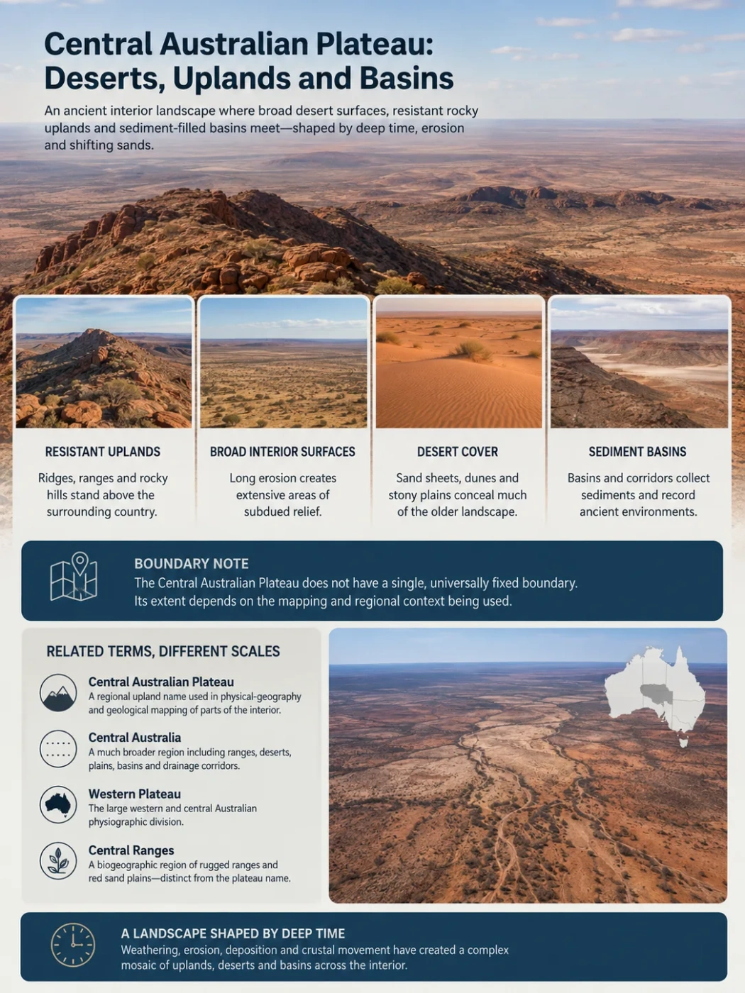
The Central Australian Plateau is best understood not as one flat, sharply bounded tableland, but as part of an ancient interior landscape where broad desert surfaces, resistant rocky uplands and sediment-filled basins meet. In northern South Australia, the name appears on regional physiographic mapping west of the Arckaringa Basin, close to the Everard Ranges and the Great Victoria Desert. The visible desert is only the uppermost layer of a much older landscape.
A Plateau Name Without One Universal Boundary
Central Australian Plateau is a real geographic name, but it does not have the kind of universally fixed boundary associated with a state or a formally defined modern bioregion. South Australian geological and groundwater mapping uses the name for elevated country along the western side of the Arckaringa Basin. On those maps it occupies part of a wider interior that also includes the Everard Ranges, Great Victoria Desert, Officer Basin and other uplands and basins.
This matters because Central Australia, the Central Australian Plateau and Australia’s much larger Western Plateau are not interchangeable names. Central Australia is a broad regional term. The Western Plateau is one of Australia’s major physiographic divisions. Central Australian Plateau is a more limited regional landform name whose exact extent depends on the geographic or geological mapping being used.
Boundary Note
A precise area figure should not be attached to the Central Australian Plateau unless it comes with a specific mapped boundary. Modern Australian environmental mapping divides this country among more precisely defined bioregions rather than treating the Central Australian Plateau as a single national bioregion.
| Term | What It Describes | How It Should Be Used |
|---|---|---|
| Central Australian Plateau | A regional plateau or upland name used in physical-geography and geological mapping of parts of the Australian interior | Use with a stated regional context rather than assuming one universally agreed boundary |
| Central Australia | A much broader geographic region containing ranges, deserts, plains, basins and drainage corridors | Do not treat the whole region as plateau terrain |
| Western Plateau | The very large western and central Australian physiographic division | Provides the larger continental setting |
| Central Ranges | A modern IBRA bioregion dominated by rugged ranges and intervening red sand plains | Use as a biogeographic unit, not as another name for the Central Australian Plateau |
Why a Plateau Landscape Contains Deserts, Ranges and Basins
The word plateau can give the wrong mental picture if it is taken to mean an uninterrupted flat surface. Central Australia’s interior has experienced immense periods of weathering, erosion, deposition and crustal deformation. The result is a landscape with broad low-relief surfaces interrupted by resistant ridges and ranges, while sedimentary basins and old drainage corridors occupy lower or structurally different ground.
Windblown sand adds another layer. Extensive sandplains and dune fields can cover the underlying geology so thoroughly that the visible desert surface no longer shows the shape of the bedrock beneath it.
Resistant rock remains as ranges, ridges and rocky hills above surrounding terrain.
Long erosion produces extensive areas of relatively subdued relief.
Sand sheets, dunes and stony surfaces partly conceal the older landscape.
Sediments, temporary runoff and groundwater may concentrate in lower structural or topographic zones.
The diagram is conceptual and not a scaled topographic cross-section.
The Desert Surface Does Not Define the Bedrock Landscape
The Great Victoria Desert forms an important part of the physical setting south and west of the central ranges. Its landscape includes extensive sandplains and dune fields, but the desert cannot be treated as a single landform made entirely of sand. Rocky outcrops, gravel surfaces, low rises and exposed older rocks interrupt the aeolian cover.
This creates an important distinction between surface cover and underlying relief. A satellite image may be dominated by long dune patterns even where those dunes lie across a much older erosional surface or above buried valleys and sedimentary rocks.
Desert and Plateau Are Different Kinds of Geography
A desert describes an environment shaped by aridity and limited moisture. A plateau describes regional topography and relief. Desert terrain can occupy a plateau, a basin, a plain or several of these landforms at once.
This distinction is especially useful in central Australia, where similar-looking red desert surfaces can cross boundaries between different geological provinces and physiographic regions. The presence of dunes alone does not show whether the ground underneath belongs to an upland, basin or lowland system.
Ancient Rocks Rise Through Younger Desert Cover
One of the clearest breaks in the low-relief desert landscape comes from the Musgrave and Everard range country. These uplands expose ancient crystalline rocks associated with the Musgrave Province, a crustal domain extending across parts of South Australia, the Northern Territory and Western Australia.
The exposed ranges are only part of that geological system. Large areas between and around them are covered by younger sand sheets and dunes. This means the modern surface can change abruptly from bare or thinly covered rock to apparently featureless desert without an equally abrupt change in the deeper geological structure.
The ranges also explain why a plateau region does not need to be uniformly flat. Long-term erosion removes rocks at different rates. More resistant units can remain as residual uplands while surrounding surfaces are lowered, mantled by sediment or dissected by drainage.
Rocky Uplands
Ranges expose old bedrock and create strong local relief. Their slopes and valleys also provide source areas for sediment and episodic runoff.
Sand-Covered Intervening Country
Red sandplains and dunes can occupy lower areas between ranges and extend across older surfaces, making bedrock structure much less obvious from the ground.
Basins Exist at More Than One Level
The word basin is particularly easy to misunderstand in this landscape. A geological basin is not necessarily the same thing as a visible bowl-shaped depression, and neither is identical to a drainage basin.
| Basin Type | What Defines It | Must It Look Like a Surface Depression? |
|---|---|---|
| Geological basin | A large structural area in which thick sequences of sedimentary rocks accumulated | No |
| Drainage basin | Land from which surface water drains toward a shared outlet or internal low | No |
| Topographic depression | Ground physically lower than its immediate surroundings | Usually |
The distinction becomes clear around the Central Australian Plateau. To its east lies the Arckaringa Basin, a geological basin beneath northern South Australia. To the south and west, the much larger Officer Basin contains a deep sedimentary succession beneath broad areas of desert terrain.
These geological basins cannot be identified simply by looking for one giant depression at the surface. Their boundaries are defined mainly by subsurface geology, including the distribution and thickness of sedimentary rocks and the structures beneath them.
The Officer Basin Lies Beneath a Much Younger Surface
The Officer Basin extends across a large area of South Australia and Western Australia and contains sedimentary rocks ranging from Neoproterozoic to Paleozoic age. Its northern margin meets the ancient Musgrave Province, creating a strong contrast between old crystalline basement and thick basin sediments.
Yet much of this geological architecture is hidden. Younger weathering products, alluvial deposits, sandplains and dunes cover the surface. A traveller crossing the desert would therefore see only fragments of the geological boundaries that can be mapped using drilling, geophysical surveys and exposed rock.
This layered structure is central to understanding the region: the visible desert landscape can be much younger than both the plateau surfaces and the rocks beneath them.
Crystalline rocks form the deep geological foundation and remain exposed in some ranges.
Sedimentary basins develop beside and across older crust while tectonic events deform parts of the interior.
Relief is reduced over long periods while resistant rocks survive as uplands and ridges.
Sand, gravel and other younger deposits spread over older landforms and conceal parts of their structure.
Old River Systems Are Buried Beneath the Desert
Modern central Australia is strongly arid, but its surface does not preserve the entire history of drainage. Palaeovalleys cross parts of the Musgrave Province and Officer Basin beneath younger sediments and desert cover. These are remnants of older drainage systems that were later filled and partly concealed.
Some palaeodrainage routes can be traced well beyond the valleys visible at the surface. Geophysical techniques and subsurface investigations are especially useful because dune fields can hide the old valley form almost completely.
Visible Modern Surface
- Longitudinal dunes and sandplains
- Rocky ranges and isolated outcrops
- Dry or intermittently active channels
- Stony and gravel-covered surfaces
Landscape Below the Surface
- Buried palaeovalleys
- Weathered bedrock
- Sedimentary basin sequences
- Groundwater-bearing sands and other aquifers
These buried valleys also matter for groundwater. In arid Australia, palaeovalley sediments can contain aquifers even where there is no permanent surface river above them. Groundwater quality and availability vary greatly, so the presence of an old valley does not automatically mean that it contains a large supply of fresh water.
Water Moves Through a Landscape That Is Usually Dry
Low rainfall does not make the plateau hydrologically inactive. The interior has many ephemeral channels that remain dry for long periods and carry water only after suitable rainfall. When runoff occurs, rocky uplands can feed water and sediment toward lower plains, floodouts and basin margins.
The western side of the Arckaringa region provides a clear example of the connection between topography and groundwater. Higher groundwater elevations occur toward the Musgrave Ranges and Central Australian Plateau, while regional groundwater movement extends toward lower parts of the surrounding basin system.
Recharge is limited and uneven in such an arid environment. Some water enters aquifers near ranges, basin margins or temporary watercourses, while other shallow groundwater bodies may be locally isolated. Surface drainage and underground flow therefore overlap without forming one simple river-to-basin system.
Plateau and range country provides topographic highs and potential recharge zones.
Runoff, sediment and some groundwater move into structurally and topographically lower terrain.
Drainage increasingly relates to the low-lying Lake Eyre basin system farther east.
The Arckaringa Basin Marks a Transition Toward Lower Interior Country
The eastern side of the plateau context differs from the desert uplands to the west. The Arckaringa Basin is bordered by a complex set of ranges, ridges and plateau margins rather than by one clean escarpment. The Everard Ranges and Central Australian Plateau lie along its western side, while other ridges and uplands define different parts of the basin margin.
The Stuart Range crosses the Arckaringa Basin and is particularly useful for understanding the shift in drainage. It helps mark the western limit of the Kati Thanda–Lake Eyre hydrological basin. Farther east, the continental interior drops toward the extensive lowland drainage system associated with Lake Eyre.
This is why the phrase deserts, uplands and basins describes more than three separate landscape types. They form a connected topographic system: elevated and resistant ground grades into lower desert plains and basin margins, while surface water, sediment and groundwater respond to those differences in relief.
Not Every Central Australian Desert Belongs to the Plateau
The geographic label central Australia extends across several major landform systems. A desert’s position in the Australian interior is therefore not enough to classify it as part of a plateau.
The Great Victoria Desert is closely associated with the Western Plateau and the upland-and-sandplain landscape around the Musgrave and Everard ranges. Farther east, however, large desert areas grade into Australia’s Interior Lowlands. The Simpson Desert and its surrounding dunefields are closely associated with this lower interior setting rather than simply being another part of the Central Australian Plateau.
Ancient uplands, broad erosional surfaces, ranges and Great Victoria Desert terrain
Arckaringa and adjoining structural and drainage margins
Lower internally drained country toward Lake Eyre and the Simpson Desert system
This strip shows a broad physiographic relationship rather than exact mapped boundaries.
Relief Is More Useful Than a Single Elevation Figure
Assigning one average elevation to the Central Australian Plateau would imply a precision that its flexible boundary does not support. Elevation varies strongly between rocky ranges, broad desert surfaces, low ridges and basin margins.
Relative relief is more informative. The Musgrave and Everard ranges stand distinctly above adjacent sandplains, while basin country to the east occupies lower regional positions. Dunes may add smaller-scale surface relief without representing uplift of the underlying plateau itself.
This also explains why satellite imagery and elevation mapping answer different questions. Satellite images are excellent for showing dune patterns, bare rock, drainage traces and surface materials. Digital elevation data reveal the broader structure beneath those visual patterns: where the land rises, where it falls and how ranges, plains and basin margins relate to one another.
Modern Bioregions Divide the Landscape Differently
Australia’s current IBRA 7.1 system does not use Central Australian Plateau as one of its 89 national bioregions. Instead, ecological and landform differences are mapped through units such as the Central Ranges, Great Victoria Desert, Finke, MacDonnell Ranges and adjoining arid bioregions.
This does not make the plateau name incorrect. It shows that physiography, geology and biogeography divide the same landscape for different purposes. A plateau boundary may follow broad relief; a geological province follows rock history; a sedimentary basin is defined largely below the surface; a drainage basin follows water movement; and a bioregion combines climate, geology, landform, vegetation and species patterns.
| Mapping System | Primary Feature Being Mapped | Central Australian Example |
|---|---|---|
| Physiographic mapping | Regional relief and landform character | Central Australian Plateau and broader Western Plateau country |
| Geological mapping | Rock units, structures and geological history | Musgrave Province and Officer Basin |
| Hydrological mapping | Surface or groundwater movement | Arckaringa groundwater systems and the Lake Eyre drainage divide |
| Bioregional mapping | Climate, geology, landform, vegetation and ecological patterns | Central Ranges and Great Victoria Desert bioregions |
The resulting boundaries overlap rather than coincide. Around the Central Australian Plateau, that overlap is particularly informative: rocky uplands, sand-covered surfaces, deeply buried basins and old drainage systems occupy the same broad interior landscape but belong to different scientific mapping systems.