INTERACTIVE CONTEXT MAP
Where is Kimberley Plateau?
The selected plateau and nearby mapped locations are shown. Open the full world atlas to explore every region.
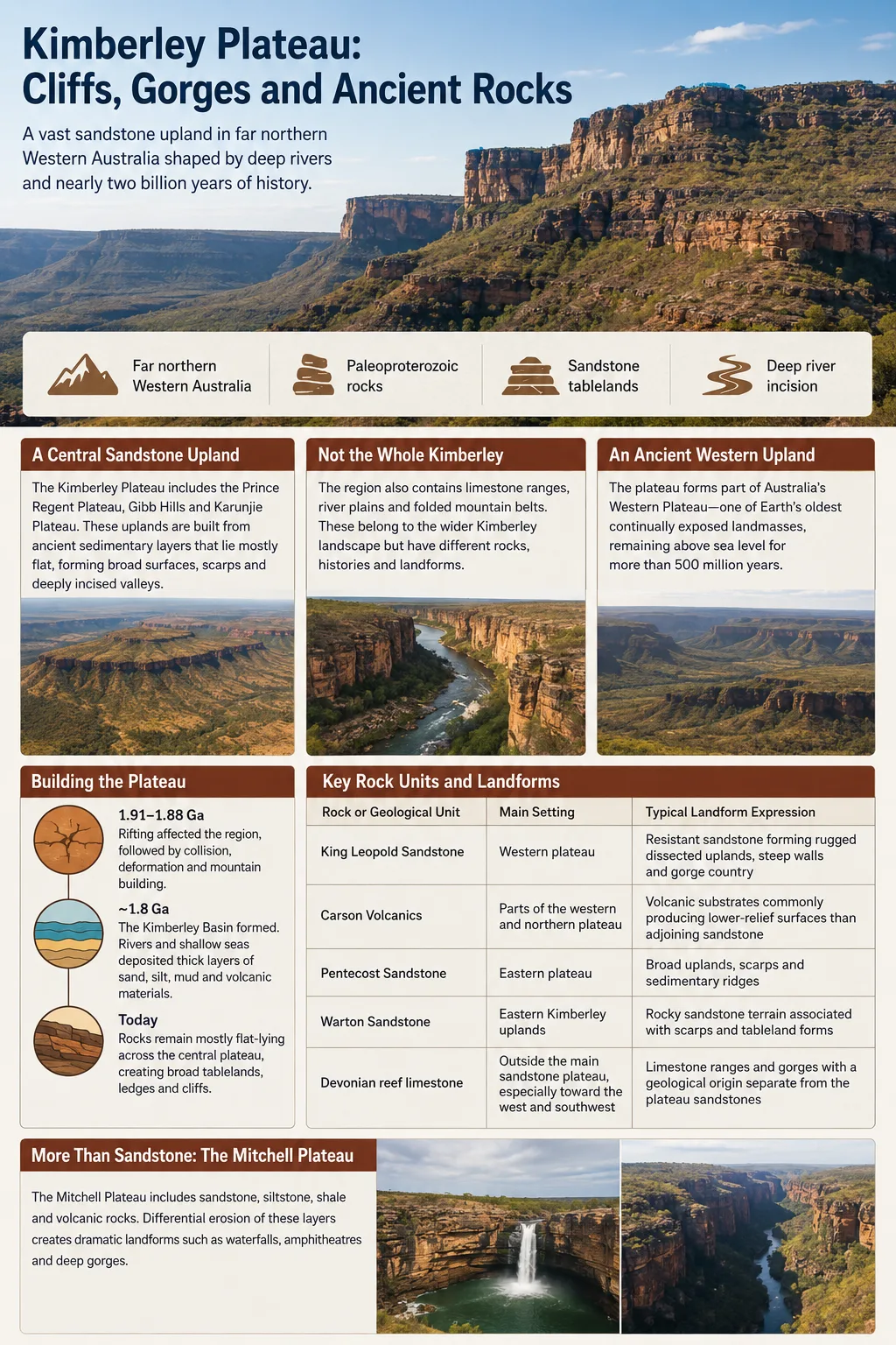
The Kimberley Plateau forms much of the elevated sandstone country of far northern Western Australia. Broad surfaces of Paleoproterozoic rock are broken by scarps, blocky cliffs and deeply incised river valleys, producing a landscape where extremely old bedrock and much younger erosional landforms occur together.
Paleoproterozoic rocks
Sandstone tablelands
Deep river incision
The Kimberley Plateau Is the Region’s Central Sandstone Upland
The name Kimberley Plateau refers to a large geological and physiographic unit within the broader Kimberley region. Its uplands include the Prince Regent Plateau in the west, the Gibb Hills and the Karunjie Plateau toward the east. Much of this country consists of nearly horizontal or gently inclined sedimentary layers resting over the ancient Kimberley crustal block.
The surrounding Kimberley contains several other landscapes with different geological histories. Folded mountain belts border parts of the plateau, broad alluvial country follows major rivers, and ancient Devonian limestone forms striking ranges farther west and southwest. Treating all of these features as one uniform plateau hides some of the most useful distinctions in Kimberley geography.
Geography Note
Kimberley Plateau and Kimberley region are not interchangeable geographical terms. The plateau is the broad sandstone-dominated upland within the region. Features such as the Devonian reef ranges, extensive river plains and strongly folded mountain belts belong to the wider Kimberley landscape but represent different rock units and landform systems.
On the continental scale, the Kimberley Plateau is one of the individual uplands associated with Australia’s immense Western Plateau. Large parts of this western Australian landmass have remained above sea level for more than 500 million years, giving erosion an exceptionally long period in which to modify old surfaces.
Rocks Nearly Two Billion Years Old Form Much of the Plateau
The geological story beneath the plateau began long before its modern cliffs and gorges appeared. Rifting affected the region about 1.91 to 1.88 billion years ago, followed by episodes of collision, deformation and mountain building during the Paleoproterozoic.
After this tectonic activity, the Kimberley Basin developed around 1.8 billion years ago. Sediment accumulated in environments ranging from rivers to shallow seas. Over time these deposits became thick successions of sandstone together with siltstone, mudstone and other sedimentary rocks. Volcanic rocks were also added to parts of the succession.
The basin rocks did not undergo the same intense deformation everywhere. Across much of the central plateau they remain comparatively flat-lying, which helps explain the broad upland surfaces, horizontal rock ledges and tableland geometry visible today.
| Rock or Geological Unit | Main Setting | Typical Landform Expression |
|---|---|---|
| King Leopold Sandstone | Western plateau | Resistant sandstone forming rugged dissected uplands, steep walls and gorge country |
| Carson Volcanics | Parts of the western and northern plateau | Volcanic substrates commonly producing lower-relief surfaces than adjoining sandstone |
| Pentecost Sandstone | Eastern plateau | Broad uplands, scarps and sedimentary ridges |
| Warton Sandstone | Eastern Kimberley uplands | Rocky sandstone terrain associated with scarps and tableland forms |
| Devonian reef limestone | Outside the main sandstone plateau, especially toward the west and southwest | Limestone ranges and gorges with a geological origin separate from the plateau sandstones |
Mitchell Plateau Reveals More Than Sandstone
The Mitchell Plateau in the north Kimberley shows why the larger upland cannot be described simply as a single sandstone sheet. Its terrain includes sandstone, basaltic volcanic rocks and lateritic surfaces. Long periods of deep chemical weathering altered basalt in parts of the plateau and produced thick lateritic material, including bauxite-bearing deposits.
This produces noticeable differences over short distances. Blocky layered sandstone can form cliffs and narrow gorges, while weathered volcanic terrain tends to support broader surfaces and deeper soils. The variation in bedrock also influences drainage, vegetation and the shape of local slopes.
Rock Age and Landform Age
The age of the bedrock should not be used as the age of a gorge. Many Kimberley Plateau rocks formed around 1.8 billion years ago, while the present valleys, cliff faces, waterfalls and gorge walls developed through much later erosion. The landscape preserves ancient geological material without requiring every visible landform to be equally ancient.
Cliffs Form Where Resistant Layers Are Cut Open
The Kimberley Plateau is often shown as a flat-topped upland, but much of its western side is heavily dissected. Rivers and smaller drainage lines have removed large volumes of rock, leaving isolated scarps, narrow ridges, stepped slopes and vertical or near-vertical sandstone faces.
Thick sandstone beds resist erosion better than many softer layers. Where a valley cuts through them, strong beds can remain exposed as cliff bands while less resistant material is removed from beneath or between them. Falling blocks and accumulated rock debris then build slopes below the cliff face.
Fractures provide another control. Sandstone across the Kimberley contains extensive joint and fracture systems. Water can exploit these lines of weakness, gradually widening them and helping drainage channels develop straight segments and angular patterns.
The Prince Regent River Shows Structural Control Clearly
The Prince Regent River is one of the clearest examples. Much of its unusually straight course follows a major fracture or geological lineament through King Leopold Sandstone. The river therefore reflects both erosion and the structure of the rock it crosses.
Similar structural controls occur elsewhere on the plateau. Straight cliff sections, abrupt changes in stream direction and rectangular drainage patterns can develop where streams repeatedly follow intersecting fractures rather than cutting randomly across intact sandstone.
Western Plateau
- Especially rugged and strongly dissected
- Large exposures of King Leopold Sandstone
- Deep valleys and numerous steep sandstone walls
- Volcanic rocks occur among the sandstone terrain
Eastern Plateau
- Generally less dissected than the western uplands
- Pentecost and Warton sandstones are widespread
- Scarps, mesas and gently dipping sedimentary ridges are common
- Relief reflects both rock resistance and the tilt of sedimentary layers
River Incision Created the Plateau’s Gorge Network
The plateau drains through several large river systems. Catchments associated with the Isdell, Prince Regent, King Edward, Drysdale and Pentecost rivers cross its uplands, while the northern part of the Fitzroy catchment reaches into its southern country. The Mitchell and other north Kimberley rivers add further deeply cut drainage networks.
These rivers cross a tropical landscape with a strong seasonal rainfall cycle. Wet-season storms can deliver intense rain over rock surfaces where soils are often thin. Runoff gathers rapidly into creeks and larger channels. Flood flows then carry sediment, move rock fragments and attack exposed bedrock.
Resistant sandstone forms broad uplands crossed by fractures and weaker rock zones.
Wet-season rainfall feeds creeks and rivers across the plateau surface.
Repeated floods remove weathered material and cut into exposed bedrock.
Valleys deepen while resistant beds remain standing as steep walls, ledges and cliffs.
River erosion has not operated at a constant rate. Changes in climate, base level and regional elevation altered the amount and location of incision. Geological studies have proposed renewed cutting of deep valleys and gorges during later phases of uplift in the Cenozoic, long after the plateau’s Paleoproterozoic rocks had formed.
The result is a landscape with two very different time scales visible at once: ancient rock layers preserve early continental history, while river channels continue to modify the surface during present wet seasons.
Waterfalls Mark Breaks in the Rock Surface
Waterfalls are common where streams encounter resistant rock ledges or abrupt changes in plateau elevation. Rather than forming independently from the gorges, many are part of the same process of river incision.
The Mitchell Plateau provides a clear example. In Mitchell River National Park, streams cross an elevated rock plain before descending through blocky, layered sandstone. Mitchell Falls and the nearby Mertens gorge system occupy this dissected surface, where channels have cut pools, narrow chasms and stepped falls into the plateau.
Farther north, the King George River passes through rugged sandstone country before reaching high cliffed terrain near the coast. Such river corridors show how the plateau grades toward deeply indented northern coastal landscapes, where old valleys were also affected by changes in sea level.
Individual waterfalls can shift as blocks fail at their edges and channels erode upstream. Their present position is therefore temporary on geological time scales even though the sandstone beneath them is immensely old.
Sandstone Gorges and Limestone Gorges Have Different Origins
Several well-known Kimberley gorges are sometimes grouped together simply because they occur in the same region. Their geology can be very different.
The deep valleys of the Kimberley Plateau commonly cut through Proterozoic sandstone and associated volcanic rocks. Windjana Gorge and Geikie Gorge, by comparison, cut through limestone belonging to an ancient Devonian reef system on the Lennard Shelf.
Those reef rocks were deposited hundreds of millions of years after the main Paleoproterozoic sandstone succession of the plateau. They preserve the remains of a large tropical carbonate system that developed around the margin of an ancient basin. Later erosion exposed the reef limestone as ranges and allowed rivers to cut through it.
This distinction explains why Kimberley gorge scenery can change sharply from one area to another. Plateau gorges commonly display massive red or brown sandstone walls and horizontal bedding, while the Devonian reef country exposes carbonate cliffs with fossil-bearing limestone and different weathering forms.
The Plateau Surface Is Old, but It Has Never Been Motionless
The Kimberley belongs to one of Australia’s longest-lived continental landscapes. The broader Western Plateau has remained land for hundreds of millions of years, and researchers have described the Kimberley uplands as an exceptionally old continuously exposed landscape.
That does not imply an unchanged surface. Weathering has repeatedly broken down exposed rock. Rivers have removed sediment. Scarps have retreated, blocks have fallen from cliff faces, drainage lines have deepened and lateritic crusts have developed over parts of the upland.
The long survival of the plateau instead reflects the persistence of a broad continental region combined with very resistant rocks. Erosion has transformed that surface without removing the entire upland. Remnants of older surfaces remain beside deeply incised valleys, making ancient tablelands and younger gorge systems parts of the same landscape.
Gorges Create Sheltered Habitats Inside the Plateau
Topography also changes environmental conditions at a local scale. Exposed sandstone uplands can have shallow soils and strong seasonal drying, while deep gorges provide shade, protected rock faces and places where moisture remains longer.
Permanent and semi-permanent pools along the river network become especially important during the dry season. Some streams contract into separated waterholes after wet-season flows decline. Sheltered drainage lines can support vegetation that differs sharply from the open woodland and grass-covered sandstone above them.
The northern Kimberley Plateau is known for small patches of monsoon rainforest and other moisture-dependent vegetation associated with protected sites. The Mitchell Plateau adds lateritic surfaces, volcanic soils and sandstone habitats to this pattern, creating close ecological changes across different rock substrates.
River systems including the Drysdale, Prince Regent, King Edward, Mitchell and neighboring north Kimberley catchments also contain unusually localized freshwater communities. The physical isolation produced by dissected sandstone, waterfalls, gorges and separated drainage basins has helped turn the plateau’s geology into an important influence on biological distribution.