Volcanic Plateau Landform
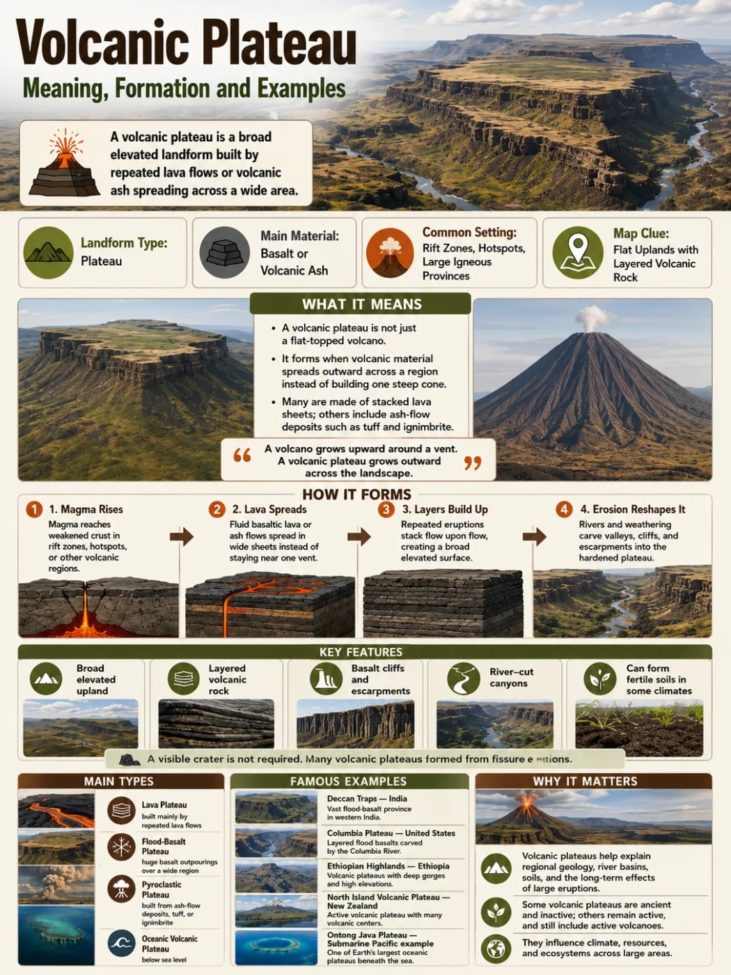
A volcanic plateau is a broad, elevated landform built by repeated volcanic eruptions, usually by lava or volcanic ash spreading across wide areas instead of piling into one steep cone.
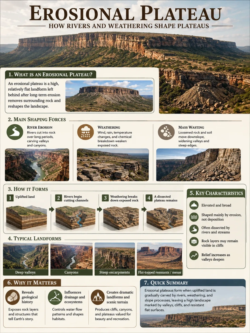
A volcanic plateau is not simply a volcano with a flat top. It is a wide highland surface formed when volcanic material spreads over a large area and hardens into stacked layers. Over time, those layers can create a raised tableland, a stepped basalt landscape, or a dissected highland cut by rivers and valleys.
The easiest way to picture it is this: a volcanic mountain grows upward around a vent, while a volcanic plateau grows outward across the landscape. Its story is about area, repeated eruptions, lava sheets, erosion, and the way rivers later carve the hardened surface.
| Feature | What It Means | Why It Matters |
|---|---|---|
| Landform | A broad elevated surface built by volcanic deposits | Shows how eruptions can shape whole regions, not only single peaks |
| Common Rock | Basalt in many lava plateaus; welded ash and tuff in some pyroclastic plateaus | Rock type affects soil, slopes, drainage, and erosion patterns |
| Formation Style | Repeated lava flows or ash-flow deposits spread over older terrain | Creates layered surfaces that may later be cut by rivers |
| Typical Shape | Flat to gently rolling upland, often edged by escarpments or deep valleys | Helps separate volcanic plateaus from cones, mesas, and ordinary plains |
| Common Examples | Deccan Traps, Columbia Plateau, Ethiopian Highlands, North Island Volcanic Plateau | Shows that volcanic plateaus occur in different climates and tectonic settings |
Geography Note
A volcanic plateau is best understood as a regional landform. A single crater, cone, or lava dome may sit on it, but the plateau itself is the wider raised surface created by many volcanic deposits.
What a Volcanic Plateau Means
A plateau is an elevated landform with a broad upper surface that rises above nearby land on at least one side. A volcanic plateau is a plateau whose main surface was built by volcanic activity.
Many volcanic plateaus form when low-viscosity basaltic lava flows out through long cracks called fissures. Instead of exploding from one central cone, the lava spreads in wide sheets. One flow cools, another flow covers it, and the stack thickens across a large area.
Some volcanic plateaus form from volcanic ash, pumice, and hot ash-flow deposits. These are often called pyroclastic plateaus or ignimbrite plateaus when welded ash-flow tuffs dominate the surface.
The result can look calm on a modern map: a broad upland, a dark basalt region, a high plain, or a tableland cut by canyons. Its origin, though, is volcanic.
Simple rule: if the landform is broad, elevated, and built mainly by repeated volcanic layers, it can be described as a volcanic plateau. If it is one steep volcanic peak, it is better described as a volcano, volcanic cone, or volcanic mountain.
How Volcanic Plateaus Form
Volcanic plateaus form through repeated volcanic events that spread material sideways over large areas. The process can vary by region, but the basic pattern is fairly clear.
1. Magma Reaches a Broad Zone of Crust
Magma rises through the crust where the rocks are weakened, stretched, or heated from below. This can happen near rift zones, mantle hotspots, or large volcanic provinces. In many basalt plateaus, magma does not use one neat central vent. It can move through long fissures and many smaller vents.
This matters because fissure eruptions spread lava across much wider ground than a typical cone-building eruption.
2. Fluid Lava Spreads as Thin Sheets
Basaltic lava is often fluid compared with silica-rich lava. It can travel across wide areas before it cools. When eruption after eruption lays down new sheets, the older surface disappears under stacked layers of dark volcanic rock.
These layers may look like steps where erosion cuts through them. This is why the word “traps” is used for some basalt regions, such as the Deccan Traps and Siberian Traps; the landscape can show stair-like layers of hardened lava.
3. The Plateau Surface Builds Up Over Time
One lava flow rarely makes a large plateau by itself. Volcanic plateaus usually need many flows, repeated eruptions, and enough time for layers to pile up. Some flood-basalt provinces contain hundreds of flows.
The upper surface may stay fairly even because each flow spreads like a sheet. Later flows fill lows in the older land, smoothing the area further.
4. Uplift, Rivers, and Erosion Reshape the Plateau
A volcanic plateau does not stop changing once the eruptions end. Rivers cut into the surface. Valleys deepen. Escarpments retreat. Weather breaks rock into soil. In wet climates, drainage networks can carve a volcanic plateau into rugged highlands. In dry climates, the surface may keep a wider, more open tableland shape.
Field Note
Layered basalt cliffs are one of the clearest field clues. Where a river or roadcut exposes the edge of a volcanic plateau, the rock may appear as stacked dark bands rather than one single volcanic body.
Main Types of Volcanic Plateaus
Volcanic plateaus are not all the same. The main difference is the material that built them and the eruption style that spread that material.
| Type | How It Forms | Typical Material | Landscape Clues | Examples |
|---|---|---|---|---|
| Lava Plateau | Repeated lava flows spread across a broad area and harden into stacked sheets | Mostly basalt in many large examples | Dark rock, layered cliffs, broad uplands, step-like edges | Columbia Plateau, Deccan Traps |
| Flood-Basalt Plateau | Very large volumes of basalt erupt through fissures over a wide region | Basalt lava flows | Regional basalt cover, deep river canyons, wide plateau surfaces | Columbia River Basalt Group, parts of the Deccan Plateau |
| Pyroclastic Plateau | Hot ash, pumice, and volcanic fragments spread as ash flows and settle into thick deposits | Tuff, welded tuff, ignimbrite | Pale volcanic rock, ash-flow sheets, eroded gullies, soft-looking slopes in places | Parts of the Taupō Volcanic Zone and other ignimbrite regions |
| Oceanic Volcanic Plateau | Large volcanic outpourings thicken oceanic crust below sea level | Basaltic oceanic crust and volcanic layers | Broad submarine high area rather than a land plateau | Ontong Java Plateau, Kerguelen Plateau |
How to Recognize a Volcanic Plateau on a Map
A volcanic plateau may not look like an obvious volcano on a basic map. It often appears as a broad highland, a basalt province, or a plateau crossed by rivers. The volcanic origin becomes clearer when the map is read together with elevation, rock type, and drainage.
- Look for broad elevation: the surface is raised above nearby plains, basins, or lowlands.
- Check the rock pattern: volcanic plateaus often show basalt, lava flows, tuff, or volcanic formations across a wide area.
- Notice river cuts: rivers may expose layered volcanic rock in canyons and valley walls.
- Look for escarpments: plateau edges may form steep steps where resistant lava layers stand above softer rocks.
- Separate surface from origin: a plateau can be eroded, forested, farmed, or urbanized and still have a volcanic base.
Map Note
A volcanic plateau does not need a visible crater at its center. Many large examples formed from fissure eruptions, so the volcanic source may be spread across a belt of vents rather than marked by one cone.
Examples of Volcanic Plateaus Around the World
Volcanic plateaus occur on continents, islands, and the ocean floor. Some are old flood-basalt provinces. Others are active or recently active volcanic highlands. Their climate, elevation, and surface shape can be very different.
| Example | Location | Main Countries or Region | Approximate Scale or Elevation | Known For |
|---|---|---|---|---|
| Deccan Traps | West-central India | India, especially parts of Maharashtra, Gujarat, Madhya Pradesh, Karnataka, and nearby areas | Present basalt cover often described at about 500,000 km²; original cover may have been much larger | Thick basalt flows, step-like terrain, black soils, and links to the wider Deccan Plateau |
| Columbia Plateau | Northwestern United States | Washington, Oregon, Idaho, and nearby parts of Nevada | Columbia River Basalt Group covers more than 210,000 km² | Layered flood basalts, Columbia and Snake River canyons, semi-arid interior landscapes |
| Ethiopian Highlands | Horn of Africa | Ethiopia and nearby highland regions | Large areas rise above 2,000 m; volcanic layers can be very thick in places | Basalt highlands, steep escarpments, Blue Nile headwaters, deeply cut valleys |
| North Island Volcanic Plateau | Central North Island | New Zealand | High volcanic interior with active and dormant volcanic features | Volcanoes, calderas, ash deposits, lava flows, Lake Taupō, and geothermal areas |
| Siberian Traps | Northern Asia | Russia, mainly Siberia | One of Earth’s largest flood-basalt provinces; preserved area is vast but estimates vary | Ancient basalt flows, trap-style terrain, and large igneous province geology |
| Ontong Java Plateau | Southwest Pacific Ocean | Submarine region north of the Solomon Islands | Broad oceanic volcanic plateau below sea level | Shows that volcanic plateaus can also form as large submarine highlands |
Deccan Traps and the Deccan Plateau
The Deccan Traps are among the best-known flood-basalt regions on Earth. They occupy a large part of west-central India and are made of many flat-lying basalt flows. In many places, erosion has cut the flows into stepped hills, cliffs, and dark rock benches.
The Deccan region also shows why a volcanic plateau can affect human geography. Basalt weathering has helped form black soils in many areas. Rivers such as the Godavari, Krishna, and Tapti are tied to the wider Deccan landscape, although their courses and basins are shaped by more than volcanic rock alone.
Columbia Plateau
The Columbia Plateau in the northwestern United States is a classic lava plateau. It sits between major western landform regions, including the Cascade Range to the west and the Rocky Mountain region farther east. The Columbia River and Snake River cut through parts of the plateau, exposing thick layers of basalt.
On a map, the Columbia Plateau may look like a dry interior basin or rolling upland. In the field, its volcanic origin is clear in basalt cliffs, columnar joints, lava-flow layers, and broad areas of dark volcanic bedrock.
Ethiopian Highlands
The Ethiopian Highlands include some of Africa’s highest plateau country. Much of the highland surface is linked to thick volcanic rocks, especially basalt layers formed during large eruptions in the geologic past. The region was later uplifted and deeply eroded, creating steep escarpments and dramatic river valleys.
This example shows a common pattern: volcanic plateaus do not always remain flat. Tectonic uplift and river erosion can turn a volcanic tableland into rugged high country while the volcanic layers still define much of its structure.
North Island Volcanic Plateau
The North Island Volcanic Plateau of New Zealand is different from older flood-basalt plateaus because it includes active volcanic systems, calderas, lava flows, ash deposits, and geothermal areas. It is a volcanic highland rather than a single basalt sheet.
This region helps explain why the term volcanic plateau can include more than one eruption style. Lava, ash, caldera collapse, and volcanic lakes can all shape the surface.
Oceanic Volcanic Plateaus
Some volcanic plateaus lie under the ocean. These are not high dry tablelands, but broad areas where volcanic activity thickened the oceanic crust. The Ontong Java Plateau and Kerguelen Plateau are often discussed as major oceanic volcanic plateaus.
They matter because the word “plateau” in geology can describe a raised surface relative to its surroundings, even when that surface is underwater.
Rivers, Basins, and Climate on Volcanic Plateaus
Volcanic plateaus strongly affect drainage. A broad lava surface can guide rivers, block older valleys, or force streams to cut new channels. Over time, rivers may slice through the plateau and reveal the stacked volcanic layers inside it.
Basalt plateaus can also hold groundwater in fractures, joints, and spaces between flows. Water movement is not the same everywhere. Some basalt layers are dense and tight. Others are broken, vesicular, or fractured, allowing water to move more easily.
Climate changes the way a volcanic plateau looks:
- Dry climates often preserve wide, open plateau surfaces and sharp escarpments.
- Humid climates can weather basalt into deep soils and dense vegetation cover.
- Cold highlands may show frost action, glacial modification, or alpine drainage patterns.
- Island volcanic plateaus can have short steep rivers, crater lakes, and geothermal areas.
Elevation Note
A volcanic plateau does not have one fixed height range. Some sit only a few hundred meters above nearby lowlands, while major highland examples rise well above 2,000 m. The defining feature is not height alone, but broad elevation plus volcanic origin.
Volcanic Plateau vs Similar Landforms
Volcanic plateaus are often confused with lava fields, shield volcanoes, mesas, and volcanic mountains. The difference usually comes down to size, shape, origin, and whether the landform is a single volcanic body or a broad regional surface.
| Landform | Main Shape | How It Forms | How It Differs from a Volcanic Plateau |
|---|---|---|---|
| Volcanic Plateau | Broad elevated tableland or highland | Repeated lava or ash deposits cover a wide region | Regional in scale and built from many volcanic layers |
| Lava Field | Surface covered by lava flows | Lava spreads across the ground from vents or fissures | May be low, young, or not elevated enough to be called a plateau |
| Shield Volcano | Wide, gently sloping volcanic mountain | Fluid lava builds a broad volcano around vents | Still centered on a volcanic edifice rather than a regional plateau surface |
| Mesa | Isolated flat-topped hill | Erosion leaves a resistant cap above softer rock | Much smaller and usually an erosional remnant, not a broad volcanic province |
| Dissected Plateau | Plateau cut by valleys and canyons | Rivers erode an uplifted surface | Can be volcanic or non-volcanic depending on the underlying rock |
| Volcanic Mountain | Peak, cone, dome, or volcanic massif | Eruptions build relief around one or more vents | More vertical and localized than a volcanic plateau |
Common Mix-Up
A lava field can become part of a volcanic plateau, but the two terms are not always interchangeable. A lava field describes lava-covered ground. A volcanic plateau describes a broad elevated landform shaped by volcanic deposits.
Why Volcanic Plateaus Matter in Geography
Volcanic plateaus are important because they connect geology with surface life. They shape river basins, soil patterns, settlement zones, farming areas, roads, and regional climate contrasts.
They Preserve the Record of Large Eruptions
Flood-basalt plateaus show that volcanic activity can affect huge areas without forming a single obvious cone. Their layered rocks record repeated eruptions, changes in lava chemistry, pauses between flows, and later erosion.
They Shape Rivers and Canyons
Rivers cutting through volcanic plateaus often expose thick stacks of rock. The Columbia River, Snake River, Blue Nile, and many smaller streams show how water can turn a broad volcanic surface into valleys, gorges, and escarpments.
They Create Distinct Soils and Land Use Patterns
Basalt can weather into mineral-rich soils in some climates. In other places, thin rocky soils, dry conditions, or steep escarpments limit farming. This is why two volcanic plateaus may support very different landscapes even when both are built from similar rock.
They Help Explain Regional Relief
A volcanic plateau can sit beside mountains, basins, plains, or rift valleys. It may look like a high plain from above, but its edges often reveal a sharper story: uplift, lava stacking, river incision, and long-term erosion all working together.
Common Misconceptions About Volcanic Plateaus
Do not identify a volcanic plateau by flatness alone. Some volcanic plateaus are deeply dissected and rugged. Others are partly buried by soil, vegetation, farms, towns, or younger sediments. Rock type and regional structure matter as much as surface shape.
A Volcanic Plateau Is Not Always an Active Volcanic Area
Many volcanic plateaus are ancient. Their eruptions ended millions of years ago. The modern landform may now be shaped more by rivers, weathering, and climate than by active lava.
A Volcanic Plateau Is Not One Giant Volcano
Large flood-basalt provinces are better understood as volcanic regions made from many flows and vents. Calling them one volcano can hide how broad and repeated the activity was.
A Volcanic Plateau Can Be Underwater
In ocean geology, a volcanic plateau can be a broad submarine high formed by volcanic thickening of the oceanic crust. It will not look like a land plateau on a normal physical map, but it still rises above the surrounding seafloor.
Not Every Plateau with Volcanic Rocks Is Purely Volcanic
Some highlands include volcanic rocks, folded rocks, sedimentary layers, faults, and eroded surfaces together. In those cases, the label depends on what built the main plateau surface and what controls its present shape.
Mini Glossary for Volcanic Plateau Terms
| Term | Meaning | Use in Plateau Geography |
|---|---|---|
| Basalt | Dark, fine-grained volcanic rock formed from fluid lava | Common rock in many lava plateaus and flood-basalt provinces |
| Fissure Eruption | Lava eruption from a long crack rather than a single round vent | Helps explain how lava can spread across wide regions |
| Flood Basalt | Large-volume basalt lava that covers broad areas in sheets | Builds some of the largest volcanic plateaus |
| Escarpment | Steep slope or cliff marking a change in elevation | Often forms along plateau edges or eroded basalt layers |
| Ignimbrite | Rock formed from hot volcanic ash-flow deposits | Can form pyroclastic plateau surfaces in some volcanic regions |
| Large Igneous Province | Very large area of igneous rock produced by major volcanic activity | Many famous flood-basalt plateaus belong to this wider geologic category |
FAQ
What is a volcanic plateau in simple words?
A volcanic plateau is a wide elevated landform built by volcanic material, usually repeated lava flows or ash deposits. It is broader than a single volcano and often looks like a high plain, tableland, or dissected upland.
How is a volcanic plateau formed?
A volcanic plateau forms when lava or volcanic ash spreads over a large area many times. The layers cool, harden, and build up a broad surface. Later, rivers, weathering, and uplift can carve the plateau into valleys, cliffs, and escarpments.
Is a volcanic plateau the same as a lava plateau?
Not always. A lava plateau is a type of volcanic plateau built mainly from lava flows. Some volcanic plateaus are built partly from ash-flow deposits, tuff, or mixed volcanic materials, so “volcanic plateau” is the wider term.
What is the difference between a volcanic plateau and a volcano?
A volcano is usually a localized landform built around one or more vents, such as a cone, dome, or shield. A volcanic plateau is a broad regional surface built by volcanic deposits spreading across a large area.
What are famous examples of volcanic plateaus?
Well-known examples include the Deccan Traps in India, the Columbia Plateau in the northwestern United States, the Ethiopian Highlands, and the North Island Volcanic Plateau in New Zealand. Oceanic volcanic plateaus include the Ontong Java Plateau and Kerguelen Plateau.
Can a volcanic plateau still have active volcanoes?
Yes. Some volcanic plateaus include active or dormant volcanic features. The North Island Volcanic Plateau in New Zealand is one example. Many other volcanic plateaus are ancient and no longer active.
Why do some volcanic plateaus have deep canyons?
Rivers can cut down through the plateau after the volcanic layers harden. Over long periods, this erosion exposes stacked lava flows and creates canyons, gorges, and steep valley walls.
How can a volcanic plateau be identified on a map?
Look for a broad elevated region, volcanic rock units, basalt or tuff formations, escarpments, and rivers cutting through layered volcanic terrain. A visible crater is not required, because many volcanic plateaus formed from fissures spread across a wide area.